Showing posts with label Bandelier. Show all posts

Thursday, April 12, 2012

Bandelier Main Loop Trail


Bandelier National Monument is located on New Mexico Route 4 near Los Alamos in northwest New Mexico. There are 70 miles of trails at Bandelier but the one to start with is the Main Loop Archaeology Trail that begins at the Visitor Center.


The Main Loop Trail is 1.2 miles to the large Tyuonyi Ancestral Pueblo ruins site and associated cliff dwellings. There is a $1.00 printed trail for the 21 stops along the trail. At the far end of the loop there is a 1 mile round trip option to continue to Alcove House. The first segment of trail follows Frijoles Creek with the steep canyon walls and Ponderosa Pines looming overhead. The canyon walls are composed of compacted volcanic ash from the eruptions of Jemez Volcano more than one million years ago.


Stop No. 4 is at a large circular Kiva. The trail guide points out that there is an inner layer of stones shows finer stonework indicating that the structure may have been rebuilt.


The Tyuonyi is only one of several large pueblos within Bandelier. This site has about 400 rooms and housed 100 people. Tree ring dating shows that construction here began more than 600 years ago, roughly around 1350 AD. This date would be after the time that the Ancestral Pueblo sites at Mesa Verde in southwest Colorado were abandoned.


Some think that Frijoles Canyon was the dividing line between two language groups. Tewa speakers live to the north and Keres speakers live to the south. The name Tyuonyi may mean a place of meeting. There are three kivas in the plaza area of the pueblo, one that has been excavated and visible at stop No. 8.


As the trail climbs to the cliff dwellings, there are good overall views of the pueblo site. The original rooms were one or two stories. Many of the rooms were for storage of food.


The soft rock in the cliff face has some natural cavities that were enlarged to create more living space. In front of the cavities, stone structures were built. One has been rebuilt to show how these might have looked.

The last segment of the interpretive trail passes by Long House. Holes in the cliff face show how high the structures were along here. By the early 1400s forty percent of the Bandelier population was located in Frijoles Canyon. In the late 1400s more than 500 people lived in this canyon area. Walkingstick Cholla is one of the common plants in the canyon area. 


The cliff face in the Long House segment has many petroglyph images to find. Another feature in this area is a bat cave. Mexican free-tailed bats and brown bats live here from mid May to mid September.

From here, the trail loops back along Frijoles Creek. At the creek the side trail to Alcove House continues north for 0.5 miles. The return loop has some interpretive signs discussing the plants and animals found here.  (Separate Post on Alcove House.)

528669_Russell Womens Fleece Hoodie Banner

Alcove House Trail at Bandelier


The trail to Alcove House is a 1 mile round trip side trail off of the Main Loop Trail at Bandelier National Monument in northwest New Mexico. Most visitors to Alcove House will hike the Main Loop Interpretive segment first.

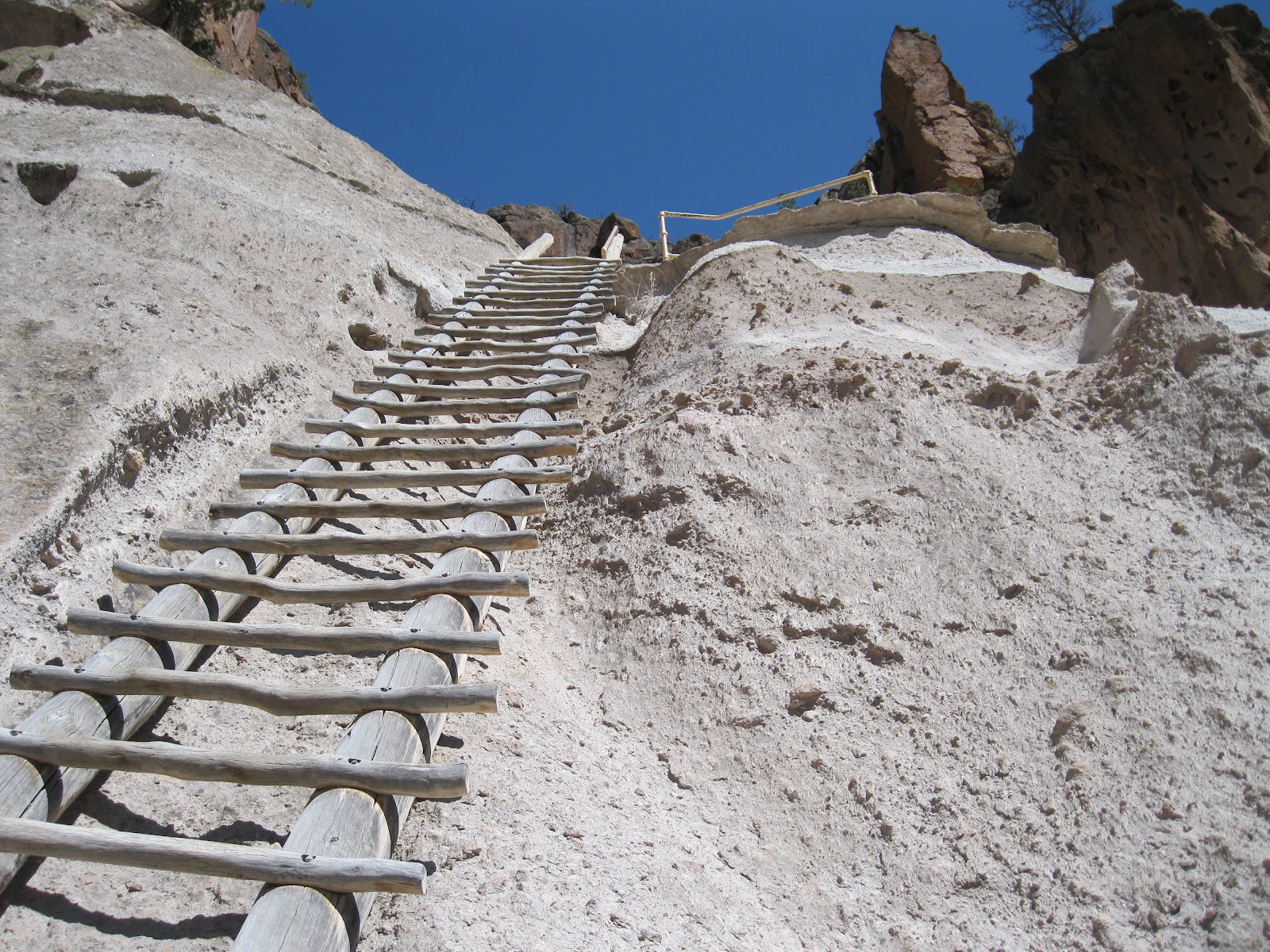
The total hiking distance for the Main Loop and the side trail to Alcove House is about 2.2 miles. The hiking challenge of the Alcove House trail is the four ladders that climb 140 feet up to the alcove.


The trail to base of the cliffs meanders along Frijoles Creek under the shade of Ponderosa Pines.  A small interpretive sign before the climb mentions that this site had 22 or 23 rooms and a kiva, and was originally known as Ceremonial Cave.


The site was occupied from 1250 to 1600 AD. The kiva was reconstructed by Archaeologist Jess Nusbaum in 1910. Nusbaum is also known as one of the early Superintendants of Mesa Verde National Park in southwest Colorado.


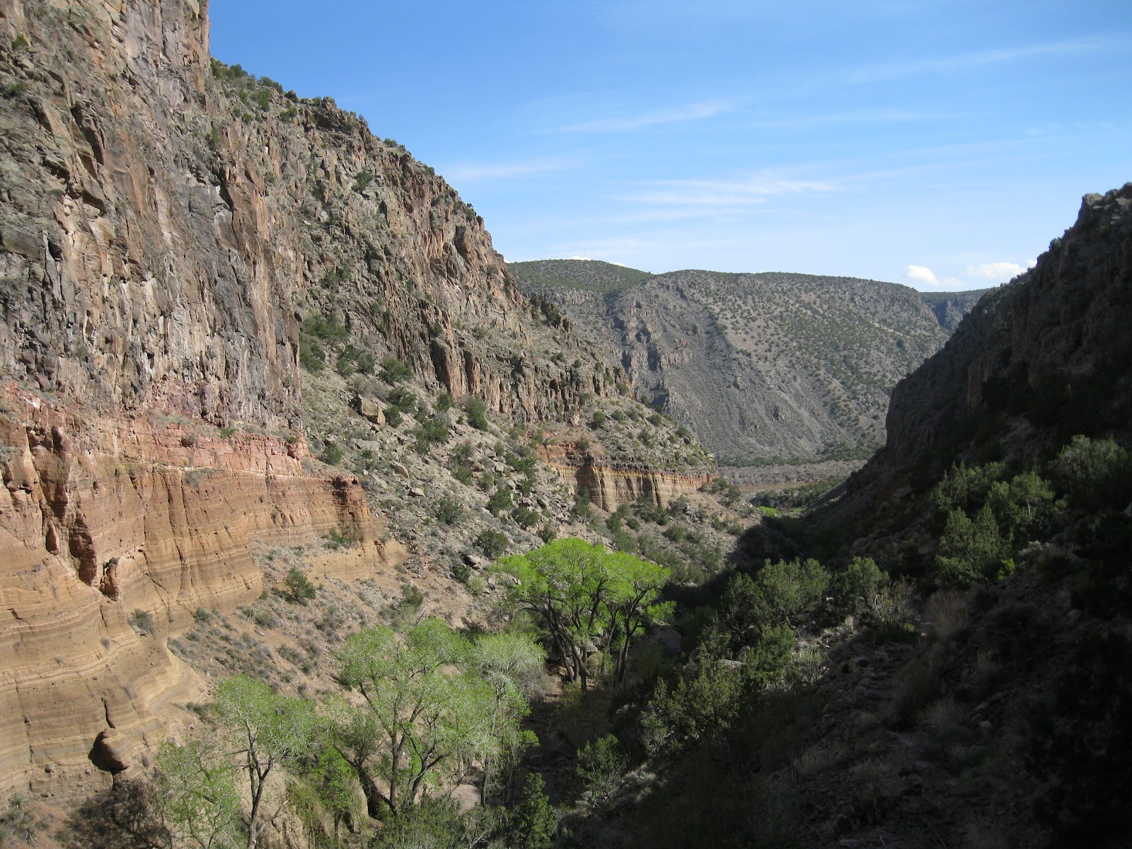
The reconstructed Kiva area has dramatic views further up Frijoles Canyon. In the alcove walls the holes where the roof beams of the constructed rooms were secured are visible.
 There is a ladder installed and visitors can descend into the kiva.


My total hike on the Main Loop Trail and the Alcove House side trail took 1:50 hours. I hiked on a pleasant 65 F degree early April day.


Wednesday, April 11, 2012

Tsankawi Trail at Bandelier


The Tsankawi Loop Trail is a 1.5 lasso loop in a detached section of Bandelier National Monument in northwest New Mexico. The trailhead is 11 miles northeast of the turnoff to the main Bandelier Visitor Center along New Mexico Route 4.


The trail visits an unexcavated large Ancestral Pueblo Ruins site on the mesa top and some cliff dwellings along the cliff face. This site was occupied in the 1400s by the Tewa people who today live at San Ildefonso Pueblo. It is interesting that the Tewa language is different than the Keres language spoken by the Pueblo people living in the Frijoles Canyon part of Bandelier only 14 miles away.


There is a printed trail guide describing 20 interpretive stops available at the trailhead for $0.50 cents. The first trail segment leads to a ladder that climbs to the lower level of cliffs. A short distance later the loop begins and the route stays to the left.

The trail here is unusual in that parts of it seem to be a trench. The rock here is the soft volcanic tuff produced from compacted ash from eruptions over a million years ago. The trail guide says that these trenches were repaired in the 1990s as hikers were eroding the ground next to the then waist deep trenches.


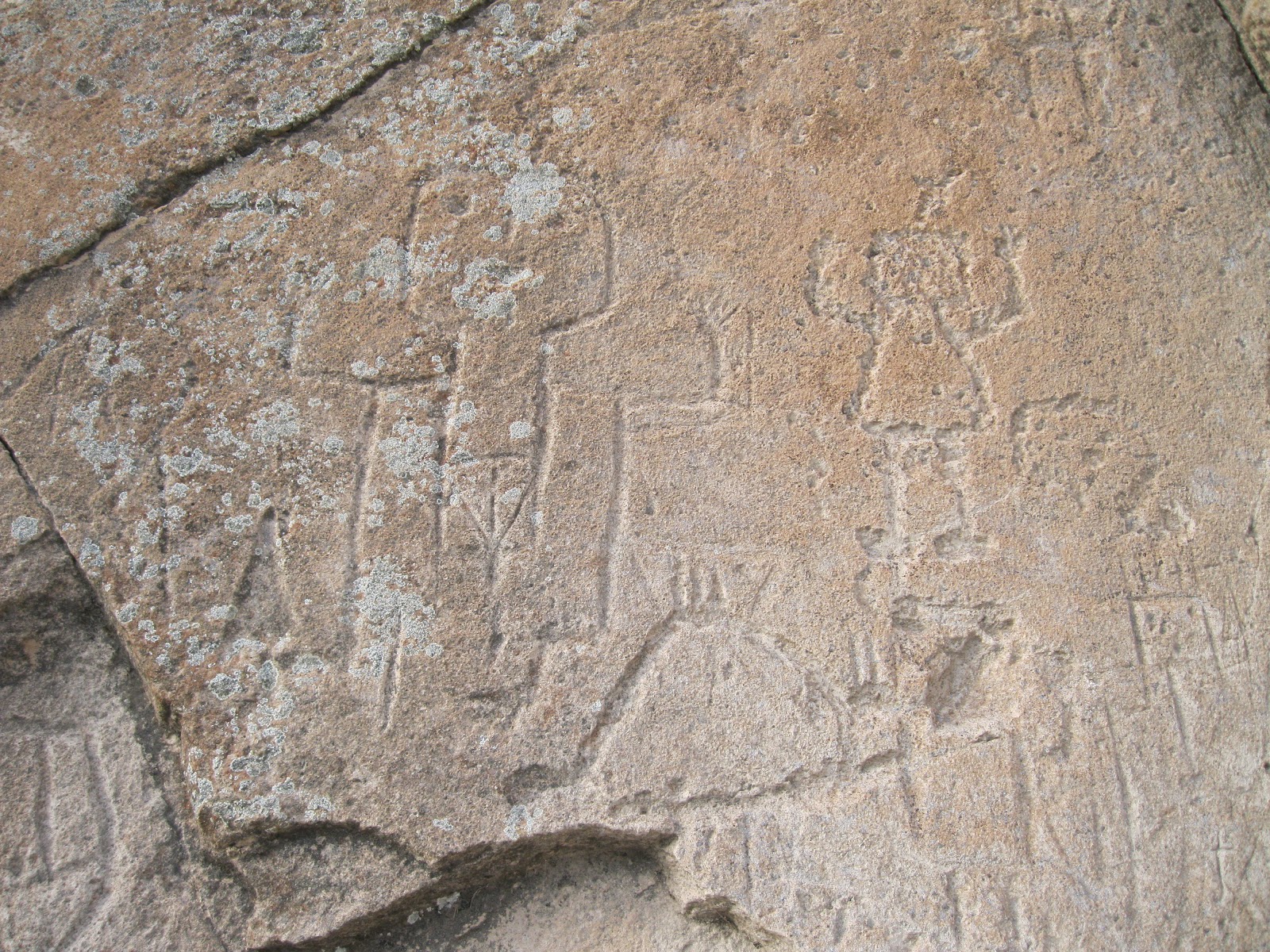
On the way up there is a good petroglyph panel. Past the petroglyph panel there is a choice of climbing a ladder or climbing up through a section of trench trail. I thought the ladder looked like the easier choice. This climb is to the upper cliff where there are great views of the surrounding area.


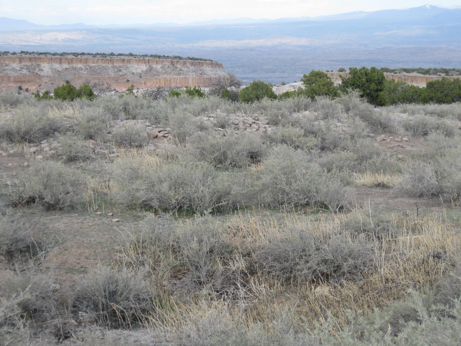
The Tsankawi name means “village between two canyons at the clump of sharp round cacti.” The extensive pueblo appears as low rubble piles overgrown with brush. The trail guide says there are about 275 ground floor rooms surrounding a central plaza. Visitors are asked to stay on the trail but the broad extent of the rubble piles is impressive.


As the trail approaches the descent off the mesa top, there are some large vertically placed stones that are thought to be part of a reservoir. Summer rains dripping off the pueblo and plaza may have been captured here.

The ladder descent off the mesa top is a little trickier than the way up and the trail guide points out that you can return the way you came.


The trail segment below has many of the cliff dwelling cavities and many more petroglyphs to view. One of the ones I noticed looked like a flute player standing on the shoulders of another figure.


These south facing cliffs receive more direct sunlight in the winter. The rock absorbs some of the heat and helps keep the inhabitants warm in cold weather. These cliffs overlook a valley where the farming of corn, beans, and squash took place. My hike took 1:30 hours on a 65 F degree early April afternoon. I didn't see any other hikers while I was on the trail.

Tuesday, April 10, 2012

Bandelier Falls Trail


The Falls Trail at Bandelier National Monument in northwest New Mexico is a 3 mile round trip to a waterfall in the lower section of Frijoles Canyon. The trailhead is at the Visitor Center area. The Falls Trail focuses on the natural environment, particularly water, and doesn’t visit any of the archaeological sites for which Bandelier is famous.


Before the 2012 season, the Falls Trail was a 5 mile round trip to two waterfalls, but the summer 2011 Las Conchas forest fire and later flash flood on August 21, 2011 washed out the lower segment of trail.

There is a printed trail guide for the Falls Trail available at the Visitor Center for $1.50. The 2012 end of the trail is at stop No. 16. There are also interpretive signs at the trailhead providing information.


The pinkish cliffs along the canyon are volcanic tuff. Between 1.6 and 1.2 million years ago there were very large volcanic explosions in the nearby Jemez Mountains that deposited thick layers of ash that later compacted to form the tuff. Running water erodes the soft rock quickly, forming steep walled canyons. At stop No. 5 there are some eroded tuff boulders called tent rocks. The trail guide provides an explanation for how tent rocks form.


This is a good view of Upper Bandelier Tuff layer from 1.2 million years ago at stop No. 7. The Upper Bandelier Tuff is widely visible around the area and is associated with the Valles Caldera volcanic area a short distance west of the Bandelier Park area. This layer is described as being deposited by pyroclastic flow.

The Frijoles Creek is a permanent stream and provided water for the early inhabitants. Following forest fires there can be severe flash floods. In 2011, this combination of events partially flooded the Visitor Center area besides washing out the lower segment of this trail. Information at the Visitor Center says that the normal Frijoles Creek flow of 10 cfs increased to 4500 cfs following 3 inches of intense rain, putting the creek three feet over its banks.


Boulders of basalt are visible along the trail. This rock is also of volcanic origin but forms during quieter eruptions. The hard Basalt found use as stone tools such as grinding and digging stones.


There is a 700 foot drop from the trailhead down to the junction with the Rio Grande River. The micro climate below is drier and spring arrives a couple of weeks earlier than higher in the canyon. The trail guide points out that the lower layer of smoother looking rock was formed by a maar volcano.

A maar volcano ejects lava through water such as a lake or aquifer. The material spit into the air was re-deposited as thin layers. The mountains in the distance are old volcanoes that produced the basalt layers along the trail.


The Upper Falls drops 80 feet over some of the resistant rock from the throat of the volcano. Some of the maar layer is visible as are the higher lava flows.

The main trees visible in Frijoles Canyon are Pinion Pines, One-Seed Junipers and the tall Ponderosa Pines. Abert or tassel eared squirrels occur here but I didn't notice any during my hike. Along the stream there are Narrowleaf Cottonwoods, Box Elders and Thinleaf Alders. In early spring these leafy trees were just starting to develop their leaves. My hike took 1:30 hours for the 3 miles on a 65 F degree early April afternoon.

(A Bandelier Park Ranger has provided some additional tips for the Falls Trail in the comments.)

                                      528614_Cool Camo Russell Outdoors