 The hike past the Kin Kletso and Casa Chiquita Great House ruins sites and the six or more petroglyph panels is 1.7 miles one way. It is about 1.0 miles more to the Chaco Wash crossing. In mid March after a heavy snow season, the narrow wash was flowing with dark silt laden water. I probed the swirling stream with a Tamarisk stick and found the bottom was very soft and the banks very slippery.
Besides getting wet at least up to your waist, there would be a danger of getting your feet stuck and falling down in a quicksand like mire. The Chaco Wash flows a short distance past the trail crossing to meet with Escavada Wash to form the Chaco River.
Among the questions about Chaco Canyon is why this seemingly dry canyon was chosen for such extensive building, and where was water supply. There is some evidence of a masonry dam near the confluence of the two washes and perhaps there were some water management efforts.
At Mesa Verde, near along the Far View Trail, there is a constructed reservoir and channel structures, signs of water management. Check dams across small washes are also evidence that water was managed in the region.
 One of the highlights of the distant end of the Penasco Blanco Trail is the Supernova Pictograph site. Even if the Chaco Wash is uncrossable, it looks like the site can be spotted from across the wash. Viewing the sandstone cliffs from high on the banks, the side trail can be sighted and it appears to end at a shallow alcove several hundred yards to the right.
On the stone wall face below the overhang some faint petroglyphs can be seen with binoculars. The alcove overhand is very narrow, and the Supernova is on the ceiling, represented as a crescent moon, a star, and a handprint.
This seemed like the right area but I couldn’t make out the images. In 1054 AD astronomers around the world recorded a supernova or an exploding star that we now call the Crab Nebula. The geography of rock art sites is often as interesting as the images themselves. This site is along a wash with a great house on the mesa top above, but otherwise is isolated.
 I didn’t make it to the mesa top to see the Penasco Blanco site but there are some distant glimpses of it from the trail leading to Chaco Wash. Besides overlooking the confluence of the two washes, it sits along an 8 mile line of sight with the Pueblo Bonito and Una Vida sites. I spent 3:30 hours on the 6 miles I hiked on a 55 F degree day in mid March. I carried 2 liters of water and drank only one.
 The trail climbs immediately to the mesa top and follows along the rocky edge. The main point of interest in the east end of Chaco Canyon is Fajada Butte. Fajada means “banded” in Spanish. The Cliff House Sandstone forms the upper layers and the softer Menefee formation the lower. A narrow layer of lignite coal is between the two.
 The site is partially excavated and has about 100 rooms built around a large plaza. This site is thought to have been occupied twice, from 1100 to 1200 and again 1250 to 1380 AD. The Puerco Pueblo sits on the cultural border of the Ancestral Pueblo to the north and the Mogollon to the south. The artifacts found here indicate that both groups made contact here.


 One of the interpretive signs along the trail explains the formation of petrified wood. Approximately 225 million years ago this area was a flood plain littered with fallen trees. Buried under layers of silt, the silica laden waters petrified the wood by encasing the organic material with minerals.
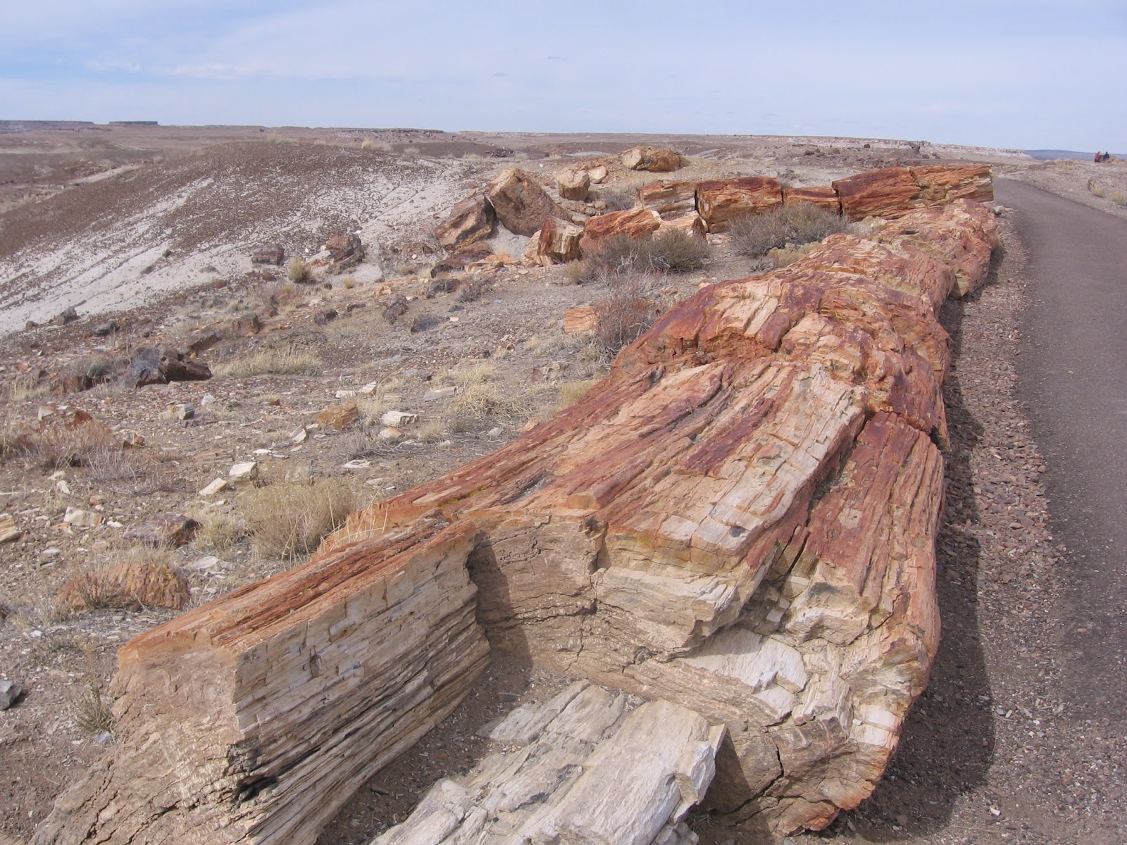

 The badlands are areas of mudstones and siltstones that are easily eroded and sculpted by wind and water. The first part of the trail descends steeply through the sandstone caprock layer that is described as a conglomerate, containing gravels that were deposited by a moving stream.
