Sunday, June 24, 2012

Narrows Rim Trail-El Malpais


The Narrows Rim Trail is a 7.8 mile round trip along the mesa top overlooking the Narrows area of El Malpais in northwest New Mexico. The Narrows is a 3 mile corridor where lava flowed close to the base of 500 foot sandstone cliffs.


The trailhead is at the Narrows Picnic Area 21 miles south of Interstate Highway 40 along Highway 117 near Grants, New Mexico.  There is a general trail guide for this hike available at the Visitor’s Centers. The elevation of the trail is over 7000 feet.


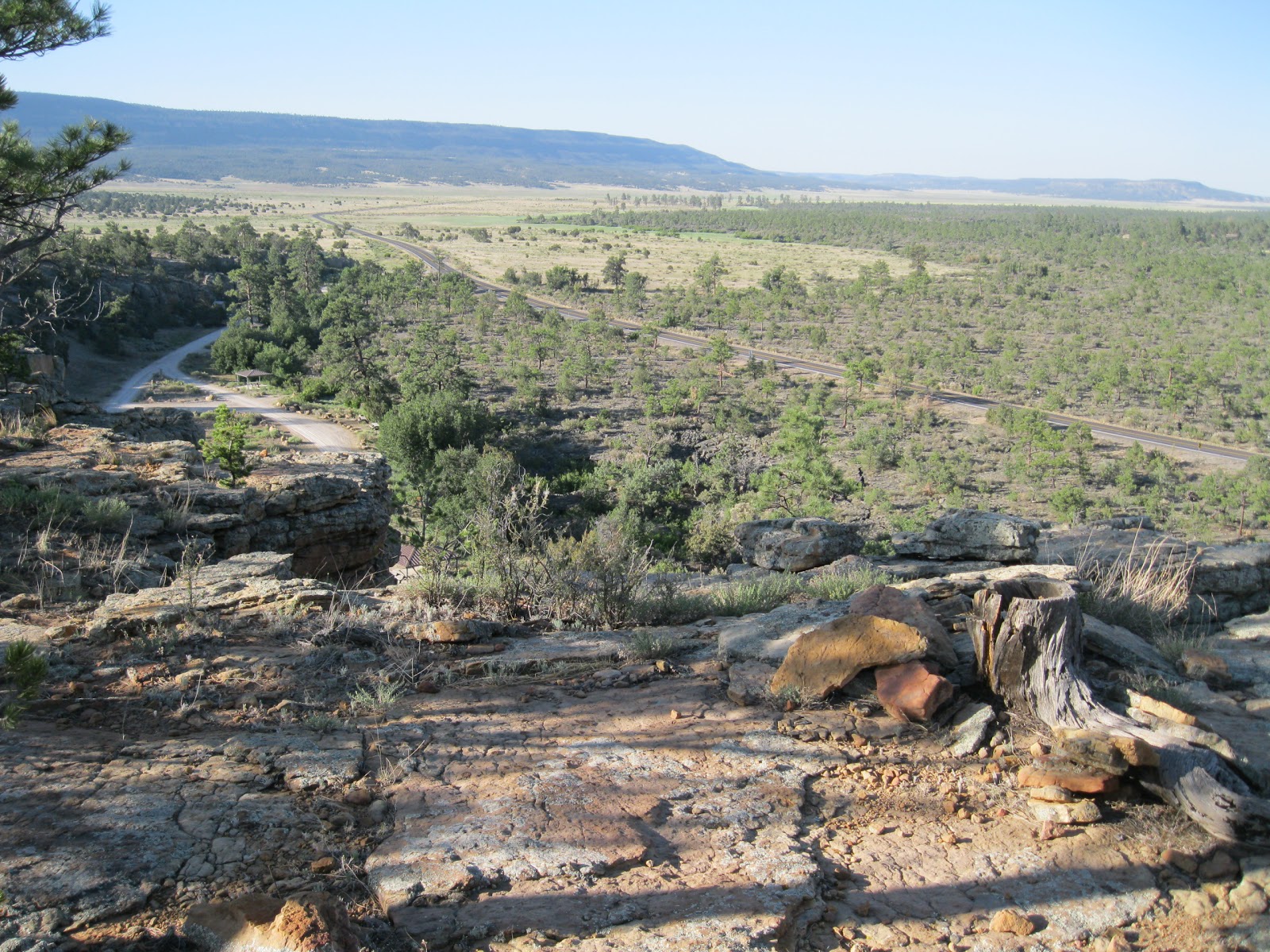
The trail climbs gradually with the picnic area is sight in the first segment. The route is well marked with rock cairns and some segments have sandy footing. The forest is Pinon Pines, One Seed Junipers, and Gambel Oaks with patches of Ponderosa Pines. I didn't see any large wildlife but the sandy trail segments had tracks of many small animals.


The trail is close to the rim the entire route and provides sweeping views the entire distance. I thought the lava flow area resembled a wavy ocean surface from this height, extending toward the mountains and volcanic cones in the distance.


The highlight at the end of the trail is an elevated view of La Ventana Arch. The trail guide describes this as a good bird watching area. I saw many swallows along the cliffs along with Turkey Vultures and Ravens, and glimpses of a few others.


The Zuni Sandstone bluffs are 160 million years while the McCarty’s Lava flow is either 1500 or 3000 years old, the information seems to vary.


It took me 1:55 hours to arrive at the La Ventana Arch view point. The return hike took 1:45 hours and the total time was 3:50 hours. I began hiking at 7:30 AM when the temperature was 61 F degrees and it was 83 F degrees at my 11:20 AM finish on a hot mid June day. I carried and drank 3 liters of water. 

544544_$20 off any hotel booking of $350 or more with code TLSALE20

Saturday, June 23, 2012

Dittert Ruins Site-El Malpais


The Dittert Ruins site is located on the southeast side of the El Malpais area of northwest New Mexico. Travel about 32 miles south from Grants on Highway 117 to a junction with gravel County Road 41, then 3.7 miles to a two track dirt road labeled Armijo Canyon Road.

The Dittert site is shown on the El Malpais park brochure and there is a specific trail guide available at the Visitor Centers.


It is 1.3 miles along Armijo Canyon Road to a parking area and fence to the Cebolla Wilderness Area. A foot trail continues east toward Armijo Canyon where there may be ruins sites and petroglyphs.


The Dittert Ruins Site is about 0.5 miles to the northeast without a trail leading to it. It is visible with binoculars as a rubble pile from the parking area and there is a large wash to cross. Cows might be grazing along the way.


The park brochure says that the site was occupied sometime between 1000 and 1300 AD by Ancestral Pueblos. It was partially excavated by Alfred Dittert from 1947-49, and is L-shaped with 30-35 rooms. The site diagram shows that 9 rooms and an enclosed kiva were excavated. The masonry looks like large sandstone slabs without much chinking with small stones. The excavated walls appear to have been stabilized with cement.


The kiva doesn’t show any floor features or support pilasters for the roof. It is thought that extended drought forced the abandonment of the site and the people moved to join the Acoma Pueblo. The site shows no sign of burning, as if the residents intended to return.


Like many remote sites, there is a hiker display of artifacts. The brochure discusses whether this is a Chaco Canyon outlier and points out the resemblances, but the question remains unanswered. This site may have been remodeled long after the Chaco influence had waned.


There are several unexcavated rubble pile sites in the near vicinity. The brochure mentions that there is a great kiva here but it was hard to tell which rubble pile it was.


The hike to the site takes 0:15 minutes if you stay on course. I spent 1:00 hour here on an 88 F degree mid June day. I was the only visitor during my hike.


18407_$5 Shipping on Orders of $99 or More!

Friday, June 22, 2012

Lava Falls Trail-El Malpais


The Lava Falls Trail is a 1.2 mile route that explores the McCarty Lava Flow area in El Malpais in northwest New Mexico. The Lava Falls area is about 30 miles south of Interstate Highway 40 on Highway 117, east of Grants, New Mexico.


There are some interpretive signs at the trailhead area. The trail has numbered stops but I didn’t find a printed guide at the trailhead. The McCarty Lava Flow is 3000 years old making it the youngest in the El Malpais area. McCarty Crater, the source of the flow is to the northwest. The route is marked with large cairns, but they resemble the natural terrain so well that they are sometimes hard to spot.


The trail is a loop with a short side trail into a crater. I followed the loop clockwise to the crater, but didn’t see the junction of the side trail with the loop and ended up returning the way I came. I looked for the other side of the loop at the trailhead but had trouble there also. In any case, the distance is the same.


There is a surprising amount of vegetation that grows on the lava flows. The trailhead information says that while the trees look young, they are actually stunted and gnarled due to the harsh conditions.


The name Lava Falls comes from a small fall of lava as it dripped over a cave. The younger lava flow passed over and older flow. Maybe that is what is pointed out at stop Number 4. To the left some lava appears to be dripping over the ledge. Some of the other features to look for include “squeeze ups, lava toes and blisters.”


Stop Number 5 is at the entrance to a crater with trail continuing to the back. Maybe this crater is the source of the flow.


The return part of the loop may pass along this lava canyon visible from stop Number 3, but I couldn't spot the markers on the other side.  It took me about 0:30 minutes to arrive at the turn around point. The return hike took 0:20 minutes and I spent another 0:20 minutes looking for the segment that I missed, for a total of 1:10 hours.  

18407_Save Big With Cabela's Fourth of July Sale & Event!

Thursday, June 21, 2012

El Malpais Ranger Station Nature Trail


The Ranger Station Nature Trail is a 1.25 mile loop behind the Highway 117 BLM Ranger Station in the El Malpais Conservation Area in northwest New Mexico. The Ranger Station is about 10 miles south of Interstate Highway 40 near Grants, New Mexico.


Following the trail clockwise, the route climbs 100 feet of elevation to the first level of mesa top. There is a trail guide that provides a map and general information without numbered stops. The trail climbs an additional 25 feet from north to south. There is a short side trail off the south end of the loop to an overlook point. The trail parking area is only open when the Ranger Station is open.


Once upon the mesa top, there are good views of the El Malpais lava flow and some of the mountains and mesas in the area. The main trees along the trail are One Seed Juniper, Pinon Pine, and Gambel Oak. There are also some Ponderosa Pines on some of the north facing slopes. Mt. Taylor is in the distance to the north, one of the sacred peaks of the Navajo.


The geology layer at the bottom is named the Zuni Sandstone from 160 million years ago. The top layer is the Dakota Sandstone from 80 million years ago. In between is an unconformity layer called the White Zone. Much of the rock that was once laid down here is missing.


The best mid June wildflower along the trail was this Tree Cholla cactus. The Ranger Station has a guide to the Native Plants of El Malpais for $3.00.


I didn’t see any large wildlife on this hike, but I saw this group of Elk later in the day on the nearby Sandstone Bluff Overlook road about 1 mile south of the Ranger Station.  My hike took 0:45 minutes on an 88 F degree mid June day.

18407_Save Big With Cabela's Fourth of July Sale & Event!

Wednesday, June 20, 2012

Casamero Pueblo Ruins


Casamero Ruins is a Chaco Canyon related site near Prewitt in northwest New Mexico. Take Interstate Highway 40 exit 63 north a short distance to historic highway 66 and turn east. After about 0.5 miles turn north on County Road 19 and continue for 4.2 miles. There aren’t any signs until you arrive at the site.


There is a short trail across the grassy field. The site is thought to have been occupied from about 1050 to 1100 AD. There are several interpretive signs in place explaining the features. This site was stabilized by the BLM in 1976. The red sandstone bluffs behind the ruins have three side by side alcoves that look like arches are forming. A few scattered Junipers are at the base of the cliffs but otherwise this site looks very dry.


The pueblo structure is L shaped with 23 rooms with one enclosed kiva. One of the interpretive signs has a plan view of all the rooms. There is an unexcavated great kiva about 250 feet to the south.


Most of the visible walls use banded masonry of thin slabs of blue limestone with smaller pieces used as chinking. There is some reddish sandstone mixed in.


In some of the walls the red sandstone dominates, with the sandstone slabs larger than the limestones. The bluffs near the site appear to be the obvious source of red sandstone. The blue limestone source isn't as obvious but might be the layers above the sandstone.


The interior circular kiva doesn’t show many of the features that are often seen with kivas, such as the pilaster roof supports or floor features. 


I looked around the area surrounding the pueblo and didn't notice any associated nearby rubble piles, though there probably are some to the north across a drainage. Neighboring ruins sites aren't mentioned on the interpretive signs. The great kiva appears as a large depression without much visible stonework. I visited Casamero for about 0:45 minutes on a warm mid June day. There weren't any other visitors during my hike.

528669_Russell Womens Dri Power V-neck
18407_$5 Shipping on Orders of $99 or More!


Saturday, April 14, 2012

Puye Cliffs Dwellings Tour


The Puye Cliff Dwellings and Mesa Top are located a few miles southwest of Espanola along Route 30 in northwest New Mexico. They are a complex of Ancestral Pueblo ruins that are considered to be an ancestral home of the present day Santa Clara Pueblo. The Santa Clara Tribe has a Welcome Center on Route 30 where tickets are purchased. Then, it is a seven mile scenic drive to the cliffs.


All the hikes here are guided with tours beginning on the hour. In 2012, the full tour to the cliffs and mesa top costs $35. The price probably keeps the tour groups comfortably small.  I arrived in time for the 10:00 AM tour and was the only person hiking along with the guide.


The first trail segment is paved and climbs to a first level of cliffs and then moves to the right. Along this level there are many cavities in the soft volcanic tuff that have been enlarged and carved out into living spaces. This first level of dwelling extends for 1 mile, though the tour doesn't visit the full extent. There is more of an opportunity here to view the interior details of these cavities than at most of the other sites in the area.

Some of the cavities have remnants of plaster. There are small storage areas and ventilation holes. The cavities formerly had stone structures in front of them. An example of a stone front structure has been reconstructed and is visible when the tour first arrives at the upper trail. The reconstructed Terrace House appears to have partially collapsed in the spring of 2012. My tour only viewed the reconstruction from a distance.

The holes in the cliff face that held the roof beams are visible. In many places there are petroglyphs. Some of the petroglyphs are thought to be sun calendars and identification symbols of the family that lived there.

It is surprising that, at the right end of the trail, there is a climb up to a second level of cliff dwellings that sits above the lower level. The second level extends for about 2100 feet. The guide said that the rock is a little more porous on the higher level and the upper dwellings weren't as desirable.

The whole complex of cliff dwellings is thought to be winter residences. The rock absorbs the winter sunlight and provides more warmth than the more exposed mesa top. The farming activity here was on the canyon floor below and not on the mesa top.


There are several examples of stairways that the inhabitants carved into the soft rock. These stairways also acted as water drainage channels. The water was collected at the bottom of the cliffs for use.


I was surprised how many artifacts were collected into small displays along the trail. There are several styles of pottery visible and many stone tools including some of the very sharp obsidian. The cliff dwellings segment of the total tour lasts about 1:00 hour. From the second level of cliffs it is not very much higher to climb to the mesa top. There is a van available, if needed, to drive visitors to the mesa top for that portion of the tour.

                                      532497_120 x 90 Starting Salary $42k. Group 1 544544_$20 off any hotel booking of $350 or more with code TLSALE20

Friday, April 13, 2012

Puye Cliffs Mesa Top Tour


The Puye Cliffs Mesa Top Tour is the second hour of the full two hour tour that also includes visiting the many cliff dwellings on two levels below the rim. The Puye Cliffs are part of the Santa Clara Reservation near Espanola in northwest New Mexico, and are considered to be their ancestral home.


On the tour that I took we climbed to the mesa top, but a van is also available to drive to the top. The Puye Cliffs were excavated from 1907 to 1910 by Edgar Hewitt. There are thought to be 700 rooms here and they were occupied for 600 years until the late 1500s.


The outlines of the extensive pueblo are visible with low reconstructed walls present. It is thought that up to 1500 people lived here, using the mesa top in summer and retreating to the cliff dwellings in winter. There are four room blocks surrounding a central plaza.


On the west side of the site, there has been some reconstruction to show how it might have looked. The Santa Clara people believe that their ancestors migrated here from Chaco Canyon and Mesa Verde. Those two areas are thought to have been abandoned by 1300 AD.


By the late 1500s, the Santa Clara had moved to the area near the Rio Grande River where they live today.

Further to the west there is a stone wall that is thought to be a reservoir. There isn't a source of water on the mesa top. This reservoir would have to capture the runoff from the summer rains.


A large kiva has also been reconstructed and can be entered. Inside, the details of the reconstructed roof can be viewed along with some of the original stonework. The underground kiva provided insulation from both heat and cold.


Before or after the Puye Cliffs Tour, visitors can see the Harvey House, a 1930s era facility for early tourists. Inside, there is a short video and some interpretive displays.