 The site is partially excavated and has about 100 rooms built around a large plaza. This site is thought to have been occupied twice, from 1100 to 1200 and again 1250 to 1380 AD. The Puerco Pueblo sits on the cultural border of the Ancestral Pueblo to the north and the Mogollon to the south. The artifacts found here indicate that both groups made contact here.
The terrain here is a short grass prairie and the residents farmed the slopes, growing cotton, corn, squash and beans. This area lacks the Pinon Pines, Junipers, and Gambel Oaks that provided wood and nuts for the sites further north. It is a slightly warmer but dryer climate here.
In early March, the well known sites at Mesa Verde are still surrounded by two of more feet of snow while here it is snow free. The interpretive signs here say the walls are 10 inches sthick and suggest that strong southwest winds were a factor in how the sight was planned.
 One of the excavated areas is marked as a kiva. This one is rectangular and doesn’t show many of the design features that the circular Mesa Verde style usually include. Mesa Verde style kivas usually show the ventilation shaft, fire pit and the bench like structure around the edge.
 This site is described as being constructed later, perhaps even after the Mesa Verde sites had been abandoned. The Petrified Forest area has enough archaeology interest that it could be a National Park even without the petrified wood.
 There is a small cliff face at the far end of the loop where several petroglyph panels are visible. The angle of view is a little awkward and binoculars would be handy to see the many images. The most eye catching image shows a curve billed shore bird holding what looks like a frog.
Nearby the Puerco Ruin Trail is the Newspaper Rock petroglyph overlook. There isn’t any hiking at Newspaper Rock, but there are 650 images arrayed on several rock surfaces. This is also a site where binoculars will be handy. The Newspaper Rock site doesn’t appear to be associated with a ruins site and the location doesn’t appear to be at a canyon junction or any obviously significant location.


 One of the interpretive signs along the trail explains the formation of petrified wood. Approximately 225 million years ago this area was a flood plain littered with fallen trees. Buried under layers of silt, the silica laden waters petrified the wood by encasing the organic material with minerals.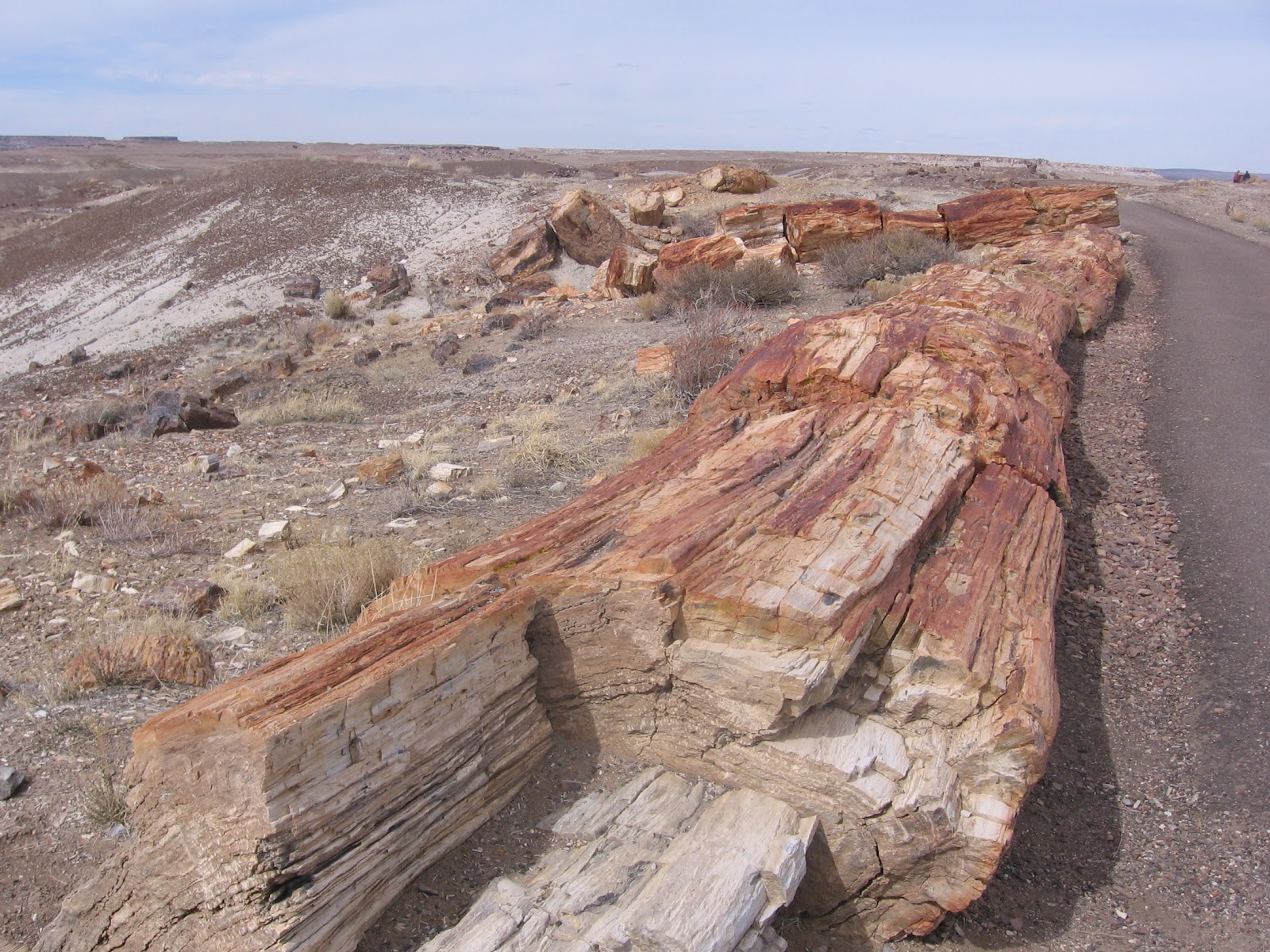

 The badlands are areas of mudstones and siltstones that are easily eroded and sculpted by wind and water. The first part of the trail descends steeply through the sandstone caprock layer that is described as a conglomerate, containing gravels that were deposited by a moving stream.


