Showing posts with label Monument Valley. Show all posts

Tuesday, November 23, 2010

John Ford’s Point

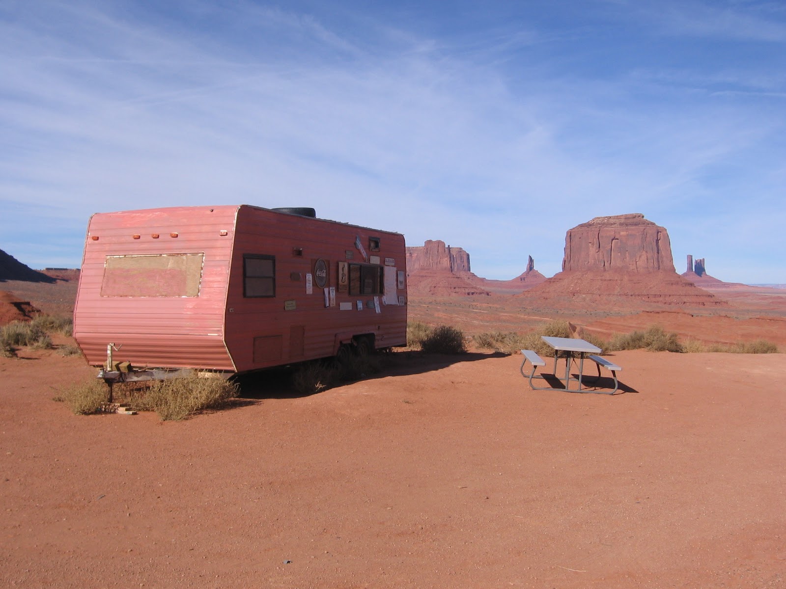
John Ford’s Point is the fourth point of interest on the Self Guiding Valley Drive Trail at Monument Valley Tribal Park in the Navajo Nation. Beside the view point, there is a short trail to walk and it is a center for viewing Navajo Arts and Crafts.


John Ford directed more than 140 films and won four Best Director Academy Awards and is regarded as one of the all time best directors. He pioneered location shooting and the long shots framing characters against rugged natural terrain such as here at Monument Valley.

Stagecoach in 1939 was the first in the series of seven Ford Westerns filmed on location in Monument Valley. It was nominated for seven Academy Awards including Best Picture and Best Director. Stagecoach was the film that elevated John Wayne to international stardom. The gift shop at the Visitor Center has several of these films for sale along with an assortment of John Wayne souvenirs.
 
Looking east, there is a head on view of Camel Butte, the fifth point of interest on the Valley Drive. Beyond is the Spearhead Mesa area that includes Artist’s Point, another major stop and view point.
 
Back to the west are the Three Sisters and Mitchell Mesa. The geology here is described as three main layers. The caprock Shinarump formation sits on the DeChelly or Cedar Mesa Sandstone that forms the sheer cliffs of the mesas and buttes. The stair steps below the buttes and spires are softer Organ Rock shales.


Part of the charm of John Ford’s Point is the array of Navajo vendors. The silver and turquoise jewelry draw a lot of attention. There is an opportunity to try the famous Navajo tacos featuring the fry bread shells as you gaze out toward Merrick Butte and the famous Mittens.


Thursday, November 18, 2010

Wildcat Trail at Monument Valley

The Wildcat Trail is a 3.2 mile lasso type loop in Monument Valley Tribal Park in the Navajo Nation along the Utah and Arizona border. It is the only hiking trail in Monument Valley that the public can travel without a guide. Most visitors at Monument Valley follow the self guiding Valley Drive or take a guided tour.


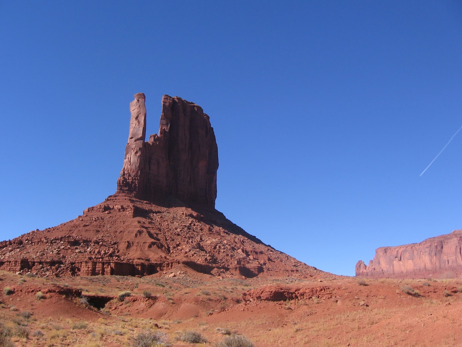
The trail head is near the visitor center, just past the right turn that descends to the Valley Drive. The trail makes a loop around the West Mitten, one of the most famous of the Monument Valley formations. There are also good views of the East Mitten.
 
Along the first segment are small signs identifying several of the desert plants. Besides the Broom Snakeweed, others mentioned include Russian Thistle, Rabbitbrush, Narrowleaf Yucca, Mormon Tea, Blackbrush, Cliff Rose, Threadleaf Groundsel, Prickly Pear Cactus, and there also scattered Utah Junipers. Along the north side of the trail is the massive Sentinel Mesa.
 

Around the north side of the loop are good views toward a group of formations that include the Big Indian, Castle Butte, King on his Throne, and Brigham’s Tomb.


Some of these same formations are among the ones in the famous view along Highway 163 approaching Monument Valley from the northeast.

Around the north side of the West Mitten I noticed a sliver of blue sky visible through the Mitten, a small arch forming. The opening is visible from both sides from the right angle, but is easier to see from the north side.
Around the east side of the loop, the trail passes directly between the East Mitten and the West Mitten.

 My hike took 1:45 hours on a 45 F degree mid November day. The park wasn’t very crowded and I saw 3 other hikers during my trip.


Tuesday, December 29, 2009

Monument Valley vs. Valley of the Gods

Monument Valley along the Utah and Arizona border and inside the Navajo Nation draws visitors from around the world. The massive carved sandstone buttes with the overlay of Navajo culture help visitors connect to the land like few other places. Not far from Monument Valley, on the north side of the San Juan River is the similar but less noticed Valley of the Gods.

Most visitors visit Monument Valley on the 17 mile Self Guiding Trail. Along the route are 11 numbered scenic stops. The best known of the stops are the two Mittens, among the most iconic rock formations in the west.


The towering formations are described as being eroded De Chelly sandstone, capped with the harder Shinarump formation. The De Chelly is also visible at the spectacular Canyon De Chelly Monument near Chinle in the center of the Navajo Reservation. Among my favorite formations along the trail is the Totem Pole and the Yei bi cheis.


If you approach Monument Valley along Highway 163 west of Bluff, Utah you will pass by the less known and lightly visited Valley of the Gods. This BLM area also has a 17 mile self guiding trail and the many formations have local names. The Valley of the Gods formations are described as being carved from Cedar Mesa Sandstone, but I think this is equivalent to the De Chelly sandstone.

Near the Valley of the Gods is the formation called Lime Ridge, important in Navajo beliefs. A trapezoidal formation that resembles the traditional Hogan dwellings holds the trapped children who were disobedient to the Sun Bearer and are being punished. When the children did not repent, the Hogan was turned to solid rock. It occurs to me that using the landscape to symbolically represent traditional stories is similar to rock art. Modern visitors often seek to find hidden petroglyphs and pictographs, but the entire landscape can be viewed as rock art also.


Besides the Monument Valley Self Guiding Trail, visitors can take guided tours into Mystery Valley and the Back Roads of Monument Valley. On these tours, some of the many Ancestral Pueblo ruins sites and rock art sites can be visited, along with several natural stone arches.

The harsh dry nature of the environment makes it hard to believe that people could live here, but there are several rock alcoves that sheltered small structures. The back roads also pass by the springs that provided water for these agricultural residents.


There aren’t any tours in the Valley of the Gods, The short brochure reminds visitors not to disturb any archeology sites, but there isn’t any information about where they might be. On my own visit I didn’t stray from the road, but there may be a good hike up Lime Canyon here.

The Cedar Mesa area just to the north is rich with ruins sites in the deep canyons and on the canyon rims. There may not be much water available in the Valley of the Gods, but there was a small spring in the vicinity of the Bed and Breakfast near the west end of the road.


Saturday, May 23, 2009

Monument Valley Back Roads

Monument Valley is most frequently visited by using the 17 mile Self Guiding Trail, a dusty and somewhat rough road where visitors use their own vehicles. The guided tours visit the same iconic rock formations, but also get onto rougher roads and find other treasures. Monument Valley Tribal Park is located along the Arizona and Utah border inside the Navajo Nation.

I took the all day tour offered by Goulding's Trading Post. The morning part of the tour visited the Mystery Valley area, finding four Ancestral Pueblo ruins sites and three large arches in addition to the massive De Chelly sandstone rock formations.


After entering Monument Valley along the Self Guiding Trail and viewing the iconic Mittens and John Ford's Point, our group of six turned off the main road to get a closer look at the formations called the Totem Pole and Yei Bi Chei. The guide led a couple of us to a point where sand dunes and desert vegetation provided a more dramatic photo angle. The Totem Pole is 400 feet tall and is among the formations that get featured in movies and commercials.

There are four large arches visited on the guided tour. The first is a large dome shaped alcove with a pothole opening at the top known as Big Hogan. A Hogan is the traditional circular, usually dome shaped dwelling structure with a hole at the top to let out smoke from the fire.

This arch could also be called Eye of the Eagle. The guide had the group lie back on the smooth rock slope at the back of the alcove and look straight up. The ceiling of the dome was such that the arch appeared as the eye of an eagle head, beak and all.


A short walk from Big Hogan Arch is Moccasin Arch. We hit the light right to get the effect of a foot print shining through the opening.


The tour passes through an area called Sand Springs. In this dry desert area with very little vegetation growing, suddenly there is a wash with some flowing water and a single large Cottonwood tree. Echo Cave Ruins is the next stop. This is a large alcove with some small Ancestral Pueblo Ruins. This area is fenced off and a close inspection is not allowed.


A short walk past the Echo Cave is a small petroglyph panel with two of the elusive Kokopelli flute players, both rotated so they seem to be reclining. These two don't seem to have a headdress or feathers that are so often seen. They are associated with a snake in this case.


The third natural arch along the trail is the Ear of the Wind, a poetic name. It is a sandy walk uphill to get a closer view.

The fourth are is also poetically named the Sun's Eye. Along the cliff wall to the left of the arch is a petroglyph panel featuring some big horn sheep.

Throughout the tour the guide pointed out that several Navajo families continue to live in the Monument Valley area where they are without running water and electricity. The Navajo don't live in villages but choose isolated family camps. Most of these families maintain traditional Hogans for ceremonial reasons.


We visited a family that had three traditional Hogans, the largest set up to display weaving of the fabulous Navajo blankets. Several of the blankets on display featured Yei Bi Chei dancers that we had just viewed in their sandstone form. I asked how old this large Hogan was and the answer was 41 years.

The inside showed the well arranged logs with a cribbed roof with a hole in the domed ceiling for the smoke stack. The exterior is packed with earth for insulation against the cold winters. This above ground style of building contrasts with the Ancestral Pueblo pit houses and Kivas that were constructed into the earth.


Wednesday, May 20, 2009

Mystery Valley Trail in Monument Valley

The Mystery Valley Trail is part of Monument Valley Tribal Park along the Arizona and Utah border inside the Navajo Nation. Mystery is only available to visitors on a guided tour.
 The tour I took was from Goulding’s Trading Post. The route we followed was south from Goulding’s along a dirt road and then entering the park at the southwest corner and following rough sandy roads. From along here there were some distant views of the famous spires, buttes, and mesas over the desert environment.

In mid May the Prickly Pear Cactus was just starting to bloom among the Sage Brush and Mormon Tea. The guide seemed to be more aware than the visitors that a cactus flower foreground with the Monument Valley spires in the distance would be a good picture.

Along the Self Guiding Trail that attracts most visitors to Monument Valley there aren’t any Ancestral Pueblo Ruins sites. Despite the very dry environment here now, there are several small ruins sites in this part of the park. The first one that the tour visited was Square House Ruin, sitting up in a nicely formed bulb of an alcove.
After viewing the ruin from the canyon floor the guide took off up a steep sandstone slope, sticking to the surface like he was a desert big horn sheep. Most of us followed for the elevated view despite the somewhat exposed short trail. To the right of the ruin on the sandstone walls there is a small petroglyph panel showing four or five elongated mountain sheep.

Just around the corner at the same stop there is the Baby Feet Ruins site. There was some confusion among our small group of six when most of us returned to the tour vehicle and the guide was missing. A short search revealed him perched up in the Baby Feet Ruin. This appears to be a small storage site. The guide said that there are some small foot prints near the small structure. Only one of us made the climb up into the site.
There are three large arches along the Mystery Valley Trail. The first one visited was Honey Moon Arch. I thought this one somewhat resembles Broken Arch in Arches National Park.

Nearby Honey Moon Arch is Half Moon Arch. Under the left side there is a large granary storage ruin. There is a spot along the canyon wall that gives a good angle to see the granary.

The third arch on the Mystery Valley Trail is the Lone Pine Arch, named for a small Pinon Pine high on the cliff on the right. This looks like a pothole type of arch. The main sandstone layer forming all the scenery is the De Chelly layer, which may be the same as the Cedar Mesa Sandstone. The valley floor is the Cutler formation and the sandstone is capped with the Shinarump layer that sometimes has been mined for Uranium.
We stopped for lunch in a canyon that was the site of the Many Hands Ruin. This small floor level ruins site is very rich in pictographs, with dozens of mostly white hand prints covering the walls. I thought that this would be a very famous site if it was located in an area with easy public access.


Only a few people per day take the guided tour here so this rich site gets only a few visitors. Besides all the hands there are some large elongated square shouldered humanoid figures, also in white.

At the upper end of this same canyon there is another ruins site called the Many Houses Ruin. This site had several low structures spread along a long curving alcove. Most of our group skipped the short walk to this site, resting and waiting for the grilled hamburger lunch prepared by the guide.

There were picnic tables and a grill in position and a tasty lunch was prepared very quickly. A small box provided by Gouldings included chips, a cookie, and an orange. After lunch we continued on to the back roads of the popular Monument Valley part of the park.


Tuesday, January 6, 2009

Monument Valley Self Guiding Trail

Monument Valley is a Navajo Tribal Park located along the Arizona and Utah border and is famous for the massive sandstone formations that are icons of the west.

 The park draws quite a few tourists arriving by the bus load. From the Visitor Center there are good views of the best known of the formations, the East Mitten and the West Mitten. The large visitor center had a display on the Navajo Code Talkers. These were Navajos serving during the World War II who used their Navajo language over the radio, unintelligible to the Japanese. In recent years these men have really become local celebrities.

The most popular tour is the Self Guided Valley Drive. The road into the valley is dusty and rough, like the Navajo Reservation, but it is really like few other places, with the massive weather carved sandstone blocks. They remind you of how tiny we are. Many of the formations have names, the first along the route is Elephant Butte.
One stop where there is some walking is John Ford's Point. One of the features of Navajo parks is that there are vendors at every stopping point selling their artwork. They are somewhat overwhelming. The stands they sell from are usually slapdash and rickety but they do have a lot of turquoise and silver jewelry, pots, kachina dolls, and the fabulous Navajo rugs. There were a lot of foreign languages being spoken at the view points, and not all ones that I could recognize.

Another popular spot along the route is Artist's Point. There are often painters with canvas set up here to paint this scene. The orange-red sandstone formations are of the Cutler Formation from the Permian period of 160 million years ago. There are at least four arches in the park that are visited on one of the guided tours.

One of the last sites along the tour is the Thumb. This formation is similar to the balanced rock type formations that occur in Arches National Park further north.