Monday, September 15, 2008

Casa Rinconda Trail at Chaco Canyon

The Casa Rinconda Trail is a 0.5 mile loop that visits three small village sites plus a Giant Kiva in Chaco Canyon National Historic Park in northwest New Mexico.

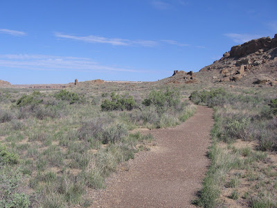
The trail head is toward the west end of the loop road on the south side of Chaco Wash and is the last major stop around the loop.

In contrast to the multi storied engineered Great Houses that dominate the canyon, these village sites were mostly one or sometimes two stories, with thinner walls, and seem to have been remodeled and added onto as needed.

These sites were in use at the same time as the Great Houses and were places where more people actually lived.
These small village sites began as pithouses, circular depressions in the earth, and expanded with a row of room blocks for storage. Eventually the circular pithouses were lined with stone and became the ceremonial kivas.
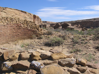
Looking across the village site to the north Pueblo Bonito, the largest Great House in Chaco Canyon, is visible. Behind Pueblo Bonito the extent of the 30,000 tons of sandstone that crashed on the back of the site in 1941 is visible.

From this angle the crashed rubble pile looks more massive than the building site is. At the back of the Casa Rinconda Trail, stop 10, the back country trail to the Tsin Klitsin site connects.

Casa Rinconda is the largest excavated Great Kiva in Chaco Canyon and one of the largest in the Chaco Culture. It is aligned on a north and south axis. The Kiva has many of the typical features such as a bench around the perimeter, niches set into the walls, a fire pit, and pits to support the large timbers that held up the roof.
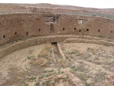
This Great Kiva has an unusual feature of a lower entryway placed beneath the steps of the northern entryway, and looks like a stone lined trench. On a previous visit here visitors were allowed to enter and walk around inside, but the way is blocked off now.

It seemed a little odd to me that such a large kiva was associated with small villages. There were many more residences here than we see but the other large kivas we see are associated with the Great Houses. Maybe it is something like a smaller college town now that can still have a giant football stadium.


Saturday, September 13, 2008

Penasco Blanco Trail at Chaco Canyon

The Penasco Blanco Trail is one of four back country trails in the Chaco Canyon National Historic Park in northwest New Mexico. The trail head is at the Pueblo del Arroyo parking lot about four miles west of the Visitor Center.


The Penasco Blanco Trail is useable by mountain bikers as well as hikers. It follows the Chaco Canyon floor to the west along the north side of the canyon. The total walk out to Penasco Blanco and a pictograph site is about 3.7 miles but the last part was closed in September 2008 due to flooding along the wash.


After about 0.5 miles the trail arrives at the Kin Kletso ruins site. Kin Kletso was among the last of the Chaco structures, built around 1120 to 1130. Pueblo Bonito was more that 250 years old by then. It uses as different style, rectangular rather than D shaped.

The masonry style uses more or less same sized, loaf shaped stones rather than the layers of large and small in the earlier periods. Another back country trail, the Pueblo Alto Trail branches off here at Kin Kletso and climbs to the mesa top to sites up above.

After another 0.7 miles Casa Chiquita comes into view. This site is similar to Kin Kletso in the style and period when it was built. 
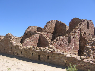
The rectangular style is thought to show the influences of the Ancestral Pueblo People who lived in the Mesa Verde area about 140 miles to the northwest. Mesa Verde is best known for the structures sited in alcoves on the sides of canyons, but there are also large mesa top pueblo sites. The Far View Trail in Mesa Verde has some good examples.

A little past Casa Chiquita there is a parallel trail that passes several petroglyph sites. Six are pointed out with small signs, but there are more than that. Some are at eye level and some high on the side of the canyon walls. The panels represent different cultures and periods of time. Some are at eye level and some high on the side of the canyon walls.
This one was particularly high and in a spot where you wonder how anyone got up there to do some art work. The human figure seems to appear in many locations around Chaco Canyon. The lower left figure looked like a flag at first but it seems to also be mounted on a post. It is thought to be a Kachina. The end of the petroglyph loop is 1.7 miles from the parking lot. I headed back from there,

(There is another post about the next segment of trail, use the labels for Penasco Blanco Trail. The Chaco Wash was flooded on this visit also.)

Thursday, September 11, 2008

Pueblo del Arroyo Trail at Chaco Canyon

The Pueblo del Arroyo is an unusual Great House in the Chaco Canyon National Historic Park in northwest New Mexico in that it is sited along the banks of the Chaco Wash rather than against the steep sandstone cliffs. It also has an unusual orientation, the flat side of the D shape faces west rather than south.


Pueblo del Arroyo used more larger loaf shaped softer tan colored sandstone from the base of the cliffs than the older sites that used a harder sheet like rock material from the top of the mesas.
On the east side near the Chaco Wash is an unusual Triple Walled circular structure. Only about a dozen similar structures have been found in the Four Corners region. Aztec Ruins, about 70 miles north, has one that the public can view. This one was built using the softer loaf shaped sandstone. The use of the triple walled rooms is not known but we usually guess ceremonial.

There is a glimpse of the Chaco Wash here. It is thought that the wash is more eroded than it was during the era when several thousand people lived here. It was a source of water as well as sand used for building.

Circling around to the east side, there is a view of the South Gap break in the mesa walls. Chaco roads entered the canyon through the Gap, connecting with farming communities and timber gathering sites. Pilgrims to Chaco also would have traveled along the Chaco road system.

Along the north side are detailed views of the kiva and room blocks of the central part of the site. In the foreground is a keyhole shaped kiva which is more typical of kivas in the Mesa Verde area, and indicates a sharing of ideas.

Around 1200 AD the Chaco area faded as the center of Ancestral Pueblo culture and the center shifted north to the Mesa Verde area. Eventually, Mesa Verde was also abandoned, with the population shifting to the Rio Grande area in central New Mexico and the Hopi Mesas in northern Arizona.

The short loop trail starts around the west wall. This site was constructed later than the nearby Pueblo Bonito, with two phases from about 1025 AD to 1125 AD.

Tuesday, September 9, 2008

Pueblo Bonito Trail at Chaco Canyon

The Pueblo Bonito Trail is a 0.6 mile loop that visits the heart of the Chaco Canyon Culture that flourished between 850 AD to about 1150 in a remote canyon in northwest New Mexico.


The trail starts about four miles west of the Visitor Center along the canyon loop road. The Chetro Ketl Trail starts at the same point and branches the other way.

The large ruin site is D shaped with the flat wall facing out toward the center of the canyon, the rounded part facing the sandstone cliffs. This orientation is the opposite from some of the other sites along the canyon wall.

The trail passes by the east corner, the circles counter clockwise to the back, then cuts through to the plaza area. At the east corner is a good view of the fine stonework of the core and veneer of the thick walls.

In 1941, following a year of heavy rains, 30,000 tons of rock broke loose from the sandstone cliffs called Threatening Rock, and destroyed about 30 rooms at the back of the site.

There is evidence that the Chaco builders recognized the danger back in 850 AD when they selected the site, and built some terrace structures to shore up the detached rock segment that had a wide crack. Prayer sticks were also installed just in case.

From an overlook point in the back there is a good view of the geometric layout and the plaza area. Construction is thought to have begun here around 850 AD and continued until about 1100 AD.

It is estimated that only 50 to 100 people actually lived here and the main use was for ceremonies, trading, hosting visitors, and other special events.

Passing through the back wall into the plaza area, the trail leads to the west corner with a view back across the entire site. There is a north and south low wall here that divides the plaza area into an east and west half.
At the center of the plaza is the Great Kiva. This is on the east side of the dividing wall. This is thought to be a structure that could accommodate hundreds for community ceremonies. There would have been a roof over it and a plaza level entry way of stairs down into the subterranean seating area.

From the plaza, a trail route for the mobile passes through a series of interior rooms. There are 11 narrow doorways to go through that are 41-46 inches high. My backpack was bumping the lintels on most of them. Besides the stonework, the method of construction of the ceilings could be viewed.

A layer of large logs supported a layer of smaller ones and layers of more plant material and mud mortar were placed on top. There are a few fragments of wall plaster in some places and the unusual feature of corner doorways.


Sunday, September 7, 2008

Chetro Ketl Trail at Chaco Canyon

The Chetro Ketl and Pueblo Bonito Trails start at the same place and branch away from each other. These are the two largest complexes at Chaco Canyon in northwest New Mexico are nearly side by side.

These two sites are about four miles west of the visitor center along the canyon loop road. The Chetro Ketl Trail is about 0.5 miles.

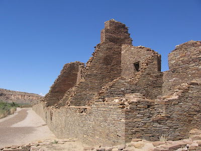
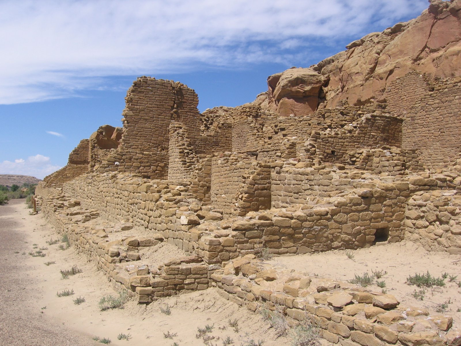
Chetro Ketl was built starting about 1000 AD and over the next 100 years grew to about 500 rooms covering 3 acres. The site is D shaped and has a large plaza area in front of the room blocks. The trail cuts through the plaza from west to east before circling around the back.

The rooms along the front wall show some evidence that there were influences from Toltec Mexico here. In the front there were originally colonnade structures, square masonry columns along the wall of a long narrow room. Later renovation appears to have filled in between the columns and then subdivided the long narrow room.

The trail continues in front of the long wall of room blocks and circles around to the subterranean Great Kiva. From the angle looking back at the main room blocks, the entry way to the kiva is visible and some of the internal features including the well like foundations for the columns that supported the roof.

Four sandstone disks were found in the foundation pit and oddly, a bag of powdered turquoise was found at the bottom.
On the east side of the plaza is a series of circular structures. One of them had an odd figure eight shape. The other circular structures have some of the features of small kivas but the figure eight appears to be featureless inside.
Passing along the back wall the stone work can be examined closely. These walls were originally covered with a plaster that has worn away.

There is evidence that along the back wall there were once small balconies on the second and third stories. The cross sections of the walls shows the somewhat jumbled core with the smooth outer veneer placement of stones.
The last part of the trail passes a structure called the Talus Unit for its location near a pile of fallen rock debris. This group of rooms is separate from the main room blocks but is thought to have been part of the system.
This area is only a few steps away from the main structures, but perhaps it had a slightly different function. Behind the Talus Unit is a stairway that connected to the roads and structures on top of the sandstone cliffs.


Saturday, September 6, 2008

Hungo Pavi Trail at Chaco Canyon

The Hungo Pavi Trail is a short 0.25 mile trail to a Chaco Canyon Ruins site located about 1.5 miles west of the visitor center at the Chaco Historical Park in a remote part of northwest New Mexico. This site is between The Una Vida site by the visitor center and the Chetro Ketl and Pueblo Bonito complex another 2.5 miles west.
 

Kivas are thought to have had important ceremonial and public gathering uses. There is a Great Kiva in the middle of the plaza but you can only see a depression.

At the back east corner of the trail there is a carved stairway into the sandstone cliff. On the mesa above are other building sites and roads connecting Chaco to outlying sites as much as 100 miles or more away.

Many of the structures in Chaco show signs of planning, such as walls thick at the bottom and tapering thinner as they rise. I thought this section looked the opposite, getting thicker as it got higher.

In these two story sections the holes where large logs that formed the ceilings and floors sometimes still have remains of the logs, which would have to have been carried here by hand from 40-60 miles away.

A row of smaller logs was placed on top of the large logs to form a mesh, which was filled in with more plant material then plastered over.

Hungo Pavi is one of the few Chaco Canyon structures to remain unexcavated and undisturbed. This site is thought to have been constructed staring around 1000 AD and continued for 150 years. The site is D shaped with the back towards the sandstone cliffs.

The trail passes through the plaza in front of the main room blocks. In the middle of the blocks, sticking out into the plaza a little is an above ground kiva, a square enclosure with a round interior.


Friday, September 5, 2008

Una Vida Trail at Chaco Canyon

The Una Vida Trail is a one mile loop to a 100 room, 5 kiva ruin site at the east end of the remote Chaco Canyon Historical Park in northwest New Mexico.

The trail head is in the parking lot of the Visitor Center, the first hiking opportunity when arriving. This site is in a natural state of preservation, having experienced little excavation or vandalism.

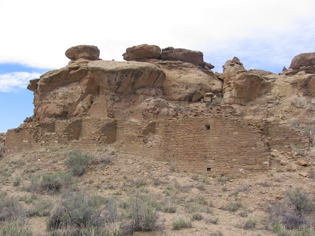
Una Vida is thought to be located along an eight mile straight line that includes the Great Houses of Pueblo Bonito in the center and Penasco Blanco on the west end of Chaco Canyon. The structures are on a slight hill on the north side of the canyon. Roads connected the sites and perhaps there was line of sight communication.

The original shape of the site is L shaped, but it's hard to see that. The trail cuts between the main room block and the plaza area. The site was terraced down the hillside. Unexcavated large circular kivas are in the center of the plaza area.

Construction of the site is thought to have started about 850 AD and continued in episodes over the next 250 years. The clues for this are the different masonry styles in different areas. The view from the site is across the Chaco Wash to the south side of the canyon.

Some of the materials from this site are thought to have been recycled by Navajo herdsmen into several traditonal hogan dwellings, an oven, and a sheep corral in the 1800s. These structures were laid dry, without using and mortar. The grass lands at the time would have supported large herds.

Toward the canyon wall side of the trail is a side route to a small petroglyph site. The Chaco area seems to be rich in petroglyphs with many sites along the length of the mostly steep sandstone canyon walls.

I thought these figures were somewhat elongated and rectangular compared to others in the region, perhaps the preferred style of the artist. These figures are often recognized as clan symbols by current day Pueblo People and trace the history of their migrations.