Showing posts with label Walnut Canyon. Show all posts

Sunday, September 18, 2011

Walnut Canyon Island Trail

Walnut Canyon National Monument preserves the cliff dwellings and mesa top pueblos of the Sinagua people who lived here between 1125 and 1250 AD. The Island Trail is a 1.0 mile loop that descends 185 feet into Walnut Canyon and passes through several biological communities.

Walnut Canyon is 10 miles east of Flagstaff on Interstate 40, in north Arizona. The Sinagua people were farmers using the mesa tops but used the ledgy alcoves in Walnut Canyon for constructing small dwellings. There are many small ruins visible, both along the trail and on the canyon walls across from the trail. The National Monuments south of Flagstaff, AZ called Montezuma Castle, Montezuma Well, and Tuzigoot are also identified with the Sinagua.

The first segment of trail descends on 240 steps and the trail is paved. Many of the diverse arrays of plants along the trail are identified, making this a good botany trail also. This is a rich area biologically with many of the life zones of North America represented in miniature. The variations in moisture and angle of sunlight result in cool areas with firs and pines and dry areas with Pinon/Juniper and desert plants. These changes can be viewed with each curve of the trail.

The small alcove ruins sites are mostly facing south to take advantage of the sun for winter survival. Most of the rooms were for storage with the larger rooms for sleeping and shelter. The rock layers here are limestone.
Despite all the resources in this area, Walnut Canyon was abandoned by 1250. The people may have been absorbed into other groups as there isn’t a Sinagua tribe today.

One of the interesting plants along the trail is Rockmat. It is a member of the Rose Family and it seems to cling to the rocky cliffs. I haven’t noticed this one elsewhere. The interpretive sign says that Navajos collect this plant for ceremonies, its only known use.

Walnut Canyon seems to have a higher density of small alcove sites than any area of the Four Corners. The population estimate for this area at its peak is 75 to 40, but the map of archaeology sites shows a very high density.

 My hike took about 1:00 hour for the 1 mile. There is also the 0.7 mile Rim Trail at Walnut Canyon that provides views of the Island area and has a mesa top pueblo site.

528614_Cool Camo Russell Outdoors

Saturday, September 17, 2011

Walnut Canyon Rim Trail

The Rim Trail at Walnut Canyon National Monument is a 0.75 mile loop that overlooks the area of the Island Trail and has an excavated mesa top pueblo ruins site of the Sinagua people. Walnut Canyon is 10 miles east of Flagstaff on Interstate 40 in northern Arizona. Besides the Rim Trail, Walnut Canyon also has the 1 mile Island Trail that descends into the canyon and passes many small alcove ruins sites.

The trail is paved and the walking is easy. Besides the views into Walnut Canyon and the many small alcove ruins sites, the Rim Trail identifies many of the diverse plant communities that occur in this lush environment.

One of the plants I noticed here that I haven’t seen in other Four Corners canyon areas is Fernbush in the Rose family.

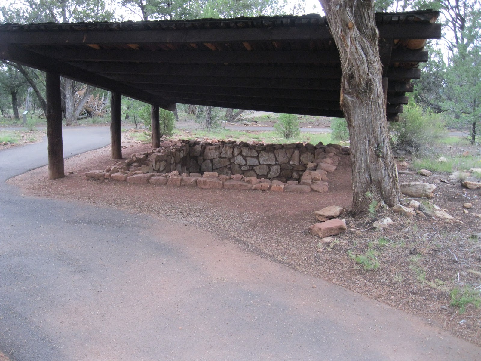
One of the highlights is the two room pueblo building. This type of structure represents the architecture used by the Sinagua around 1100 AD. The Sinagua people farmed the mesa top area, growing corn, beans, and squash. They also gathered acorns and pinion nuts, and hunted large and small game.

Across from the two room pueblo is a structure described at a pit house. This represents an earlier form of dwelling and may have later been used for storage.

In the vicinity of the two room pueblo, there is also an unexcavated site that appears as a pile of rubble. The interpretive information says that there are many sites like this in the Monument area that are being left undisturbed for now.

There is an interesting example of the diversity of plant life in the Walnut Canyon area along the Rim Trail. At one spot the Utah Juniper, Oneseed Juniper, and Rocky Mountain Juniper are growing side by side. The Utah Juniper is the most common in the Four Corners area and the Rocky Mountain Juniper grows commonly in places that are a little moister. The Oneseed Juniper is not as common and is recognized by having many limbs rising from the ground rather than a distinct trunk. There is also an example of the Alligator Juniper growing along the Island Trail.

My hike on the Rim Trail was in early September and took 0:25 minutes.