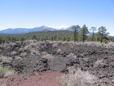
The Lava Flow Trail is a 1.0 mile loop at the foot of Sunset Crater Volcano in Sunset Crater National Monument in northeast Arizona near Flagstaff.
Sunset Crater is the youngest of many cinder cone volcanoes in the north Arizona area. The eruption date for Sunset Crater is between 1040 and 1100 AD. The date was established from the wood in the buried pithouses found under the cinders. The height of the cone is1000 feet and the diameter at the base is one mile. It is 2250 feet from rim to rim.
The ash fall from the eruption extended over 800 square miles. The first part of the trail is a paved loop, while the distant loop passes through a lava flow and cinder barrens. Sunset Crater is closed to climbing to the rim. There is a trail guide here with 13 marked stops plus several interpretive signs.
One of the features of the lava flow is an example of a “squeeze up.” As the lava flows, a thin crust forms on the surface. An increase in flow causes the crust to bulge and crack. The crack continues to widen and the molten lava below squeezes up through the crack.
All of the lava, whether jagged blocks called aa, or ropey surfaced pahoehoe, or cinders is basalt rock. There is a display in the visitor center that says basalt is a low viscosity type of lava and has 48 to 55% silica content.


No comments:
Post a Comment