Monument Valley along the Utah and Arizona border and inside the Navajo Nation draws visitors from around the world. The massive carved sandstone buttes with the overlay of Navajo culture help visitors connect to the land like few other places. Not far from Monument Valley, on the north side of the San Juan River is the similar but less noticed
Valley of the Gods.

Most visitors visit Monument Valley on the
17 mile Self Guiding Trail. Along the route are 11 numbered scenic stops. The best known of the stops are the two Mittens, among the most iconic rock formations in the west.
The towering formations are described as being eroded De Chelly sandstone, capped with the harder Shinarump formation. The De Chelly is also visible at the spectacular Canyon De Chelly Monument near Chinle in the center of the Navajo Reservation. Among my favorite formations along the trail is the Totem Pole and the Yei bi cheis.
If you approach Monument Valley along Highway 163 west of Bluff, Utah you will pass by the less known and lightly visited
Valley of the Gods. This BLM area also has a 17 mile self guiding trail and the many formations have local names. The Valley of the Gods formations are described as being carved from Cedar Mesa Sandstone, but I think this is equivalent to the De Chelly sandstone.
Near the Valley of the Gods is the formation called Lime Ridge, important in Navajo beliefs. A trapezoidal formation that resembles the traditional Hogan dwellings holds the trapped children who were disobedient to the Sun Bearer and are being punished. When the children did not repent, the Hogan was turned to solid rock. It occurs to me that using the landscape to symbolically represent traditional stories is similar to rock art. Modern visitors often seek to find hidden petroglyphs and pictographs, but the entire landscape can be viewed as rock art also.

Besides the Monument Valley Self Guiding Trail, visitors can take guided tours into
Mystery Valley and the
Back Roads of Monument Valley. On these tours, some of the many Ancestral Pueblo ruins sites and rock art sites can be visited, along with several natural stone arches.
The harsh dry nature of the environment makes it hard to believe that people could live here, but there are several rock alcoves that sheltered small structures. The back roads also pass by the springs that provided water for these agricultural residents.
There aren’t any tours in the Valley of the Gods, The short brochure reminds visitors not to disturb any archeology sites, but there isn’t any information about where they might be. On my own visit I didn’t stray from the road, but there may be a good hike up Lime Canyon here.
The Cedar Mesa area just to the north is rich with ruins sites in the deep canyons and on the canyon rims. There may not be much water available in the Valley of the Gods, but there was a small spring in the vicinity of the Bed and Breakfast near the west end of the road.
 The badlands are areas of mudstones and siltstones that are easily eroded and sculpted by wind and water. The first part of the trail descends steeply through the sandstone caprock layer that is described as a conglomerate, containing gravels that were deposited by a moving stream.
 The badlands areas are rich with fossils and clues to the past. Teeth and bones of long extinct reptiles have been found. The fossils aren’t very apparent from the trail but there are many pieces of petrified wood visible. In some spots the hard petrified wood sits on a pedestal.
  This is a small ruins site but it is unusual in the Canyon de Chelly as it is near the canyon rim rather than near the canyon floor. Most of the ruins sites at Canyon de Chelly are near the farming fields, peach orchards and water supplies that make the floor area livable.
 In winter, the roads to the overlooks and parking areas are cleared of snow. The climate today at the mouth of the canyon is mostly dry but the upper ends of the canyon catch the winter storms. The melting snows make this area one of the best watered areas of the Navajo Reservation. There are seven overlook areas on the south rim and three on the north rim. Only the White House Ruins Trail can be hiked without an official guide.

 One of the striking features of Aztec Ruins is the green band of stones along the first part of the 700 yard trail. The masonry styles are of interest in these sites as there are distinct differences from different regions and different time periods. The sandstone used here was carried by hand from quarries several miles away. There are other shorter segments of green bands near the end of the trail.
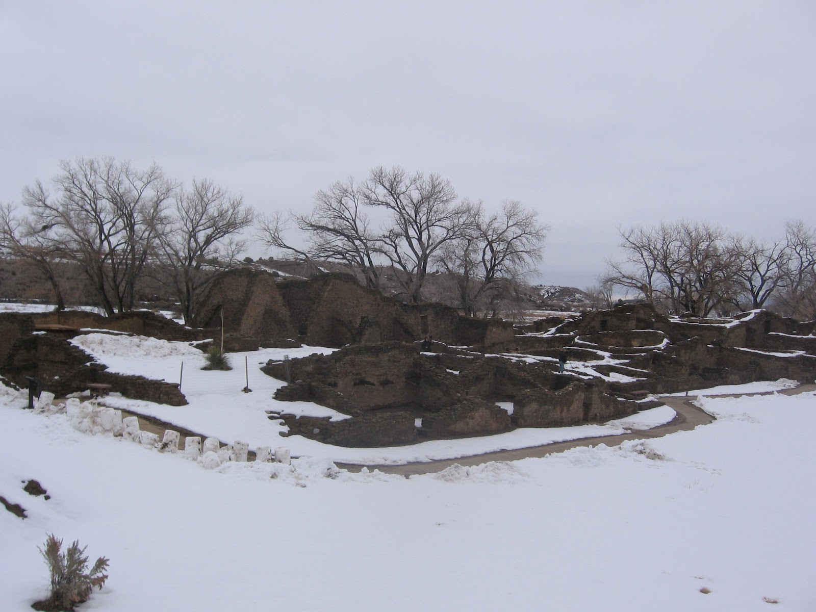


