Tuesday, February 16, 2010

Canyon de Chelly in the Snow

Canyon de Chelly National Monument in northeast Arizona is one of the most beautiful canyons in the southwest. The sheer walls of De Chelly sandstone were deposited 230 to 250 million years ago under desert conditions. The DeChelly sandstone is also visible in Monument Valley and is equivalent to the Cedar Mesa sandstone in southeast Utah.

In winter, the roads to the overlooks and parking areas are cleared of snow. The climate today at the mouth of the canyon is mostly dry but the upper ends of the canyon catch the winter storms. The melting snows make this area one of the best watered areas of the Navajo Reservation. There are seven overlook areas on the south rim and three on the north rim. Only the White House Ruins Trail can be hiked without an official guide.

In mid February the White House Ruins Trail is clear with patches of snow on the north facing slopes. The trail is a 3 miles round trip with 600 feet of elevation change. On a 40 F degree day the canyon tours are running and Navajo vendors have displays of their artwork for sale. There is a small alcove type arch along the trail in the upper part of the trail. The canyon walls around the White House ruins have some small pictographs to find.
The Navajo Fortress in at the Antelope House Overlook on the north rim. The Navajo are an Athabascan speaking people that entered Canyon de Chelly about 300 years ago. The canyon came to support good corn fields and peach orchards. Raids and counter raids between the Navajo and their Indian and Spanish enemies dragged on for 100 years with the Navajo Fortress becoming one of the refuges used against attack.

The Navajo Fortress lies at the junction of Del Muerto and Black Rock Canyons. This site continued to be used into the 1860s. Navajo Fortress appears to be connected to the adjacent canyon walls but it is actually an island of rock.

Mummy Cave Ruins is featured on the cover of the park brochure. The Mummy Cave overlook is about 12 miles up the canyon along the north rim. This spectacular site might be the longest occupied Ancestral Pueblo site in the canyon. The view from the overlook is a long distance away, but the structures in the center tower of the site appear to be very well preserved. They are described as Mesa Verde in style and contrast with the coarser style on each side. Perhaps people from Mesa Verde moved here after 1280.

Monday, February 1, 2010

Aztec Ruins in Winter

The trail at Aztec Ruins National Monument is cleared for winter visiting of this very large ruins site in northwest New Mexico. Aztec Ruins is thought to have been influenced by both Chaco Canyon and Mesa Verde before being abandoned around 1300 AD.

One of the striking features of Aztec Ruins is the green band of stones along the first part of the 700 yard trail. The masonry styles are of interest in these sites as there are distinct differences from different regions and different time periods. The sandstone used here was carried by hand from quarries several miles away. There are other shorter segments of green bands near the end of the trail.

The thick stone walls and the snow bring to mind the business of keeping warm in the winter. Stone isn’t a good insulation material and thicker walls would be useful for preserving heat. The thick walls also would support the upper levels of the structure.

The question might be which was more important, having upper stories or having more insulation? The below ground kivas would also provide some earth contact shelter from the harsh winters. The kivas are designed with ventilation shafts and a roof opening to allow smoke to escape but the extensive room blocks at most sites are not.

I haven’t seen the concept of thermal mass mentioned at any of the ruins sites in the Four Corners region. In arid climates, the building material will absorb solar energy during the day and release the stored heat during the cool evenings. The effect is to dampen the temperature swings and make the internal space more comfortable. Adobe houses take advantage of thermal mass. The earth packed Hogans of the Navajo would also.

The Pit Houses of the ancestors of Aztec Ruins take advantage of both thermal mass and earth contact. The alcove sites at Mesa Verde are mostly south facing to catch more of the winter sun. At Aztec Ruins the entire site is south facing, the open plaza faces the south and the back wall faces the north.

There is also a question of fuel for these sites also. The main trees that grow in the area are Pinon Pines and Utah Junipers. In the better soil areas sage brush grows. Interpretive information from around the region suggests that the Pinon Pines wouldn’t be cut down as they provide a nutritious and high calorie nut.

The sagebrush cleared from farming fields would be a good candidate for fuel as it burns hot. There are Cottonwood trees nearby along the Animus River. The interpretive information says that Cottonwood would be burned in summer as it provided a bright light but not much heat.

I noticed two grinding stones along the sidewalk near the visitor center. The visitor center has a small museum with a few artifacts and displays and a video room. One interesting pottery piece has a spiked surface that might be modeled after the seed pod of the highly toxic, hallucinogenic Datura plant.

My visit at Aztec Ruins was for about 2:00 hours on a 37 F degree late January day. The trail was clear with a few icy patches. There was about 1 foot of snow in the uncleared areas.

A trail guide to Aztec Ruins National Monument


Tuesday, December 29, 2009

Monument Valley vs. Valley of the Gods

Monument Valley along the Utah and Arizona border and inside the Navajo Nation draws visitors from around the world. The massive carved sandstone buttes with the overlay of Navajo culture help visitors connect to the land like few other places. Not far from Monument Valley, on the north side of the San Juan River is the similar but less noticed Valley of the Gods.

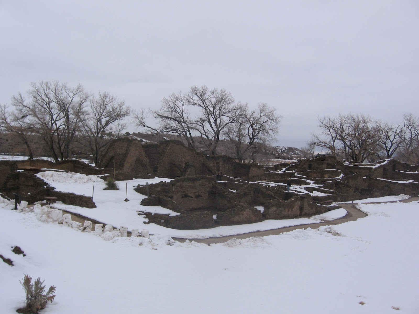
Most visitors visit Monument Valley on the 17 mile Self Guiding Trail. Along the route are 11 numbered scenic stops. The best known of the stops are the two Mittens, among the most iconic rock formations in the west.


The towering formations are described as being eroded De Chelly sandstone, capped with the harder Shinarump formation. The De Chelly is also visible at the spectacular Canyon De Chelly Monument near Chinle in the center of the Navajo Reservation. Among my favorite formations along the trail is the Totem Pole and the Yei bi cheis.


If you approach Monument Valley along Highway 163 west of Bluff, Utah you will pass by the less known and lightly visited Valley of the Gods. This BLM area also has a 17 mile self guiding trail and the many formations have local names. The Valley of the Gods formations are described as being carved from Cedar Mesa Sandstone, but I think this is equivalent to the De Chelly sandstone.

Near the Valley of the Gods is the formation called Lime Ridge, important in Navajo beliefs. A trapezoidal formation that resembles the traditional Hogan dwellings holds the trapped children who were disobedient to the Sun Bearer and are being punished. When the children did not repent, the Hogan was turned to solid rock. It occurs to me that using the landscape to symbolically represent traditional stories is similar to rock art. Modern visitors often seek to find hidden petroglyphs and pictographs, but the entire landscape can be viewed as rock art also.


Besides the Monument Valley Self Guiding Trail, visitors can take guided tours into Mystery Valley and the Back Roads of Monument Valley. On these tours, some of the many Ancestral Pueblo ruins sites and rock art sites can be visited, along with several natural stone arches.

The harsh dry nature of the environment makes it hard to believe that people could live here, but there are several rock alcoves that sheltered small structures. The back roads also pass by the springs that provided water for these agricultural residents.


There aren’t any tours in the Valley of the Gods, The short brochure reminds visitors not to disturb any archeology sites, but there isn’t any information about where they might be. On my own visit I didn’t stray from the road, but there may be a good hike up Lime Canyon here.

The Cedar Mesa area just to the north is rich with ruins sites in the deep canyons and on the canyon rims. There may not be much water available in the Valley of the Gods, but there was a small spring in the vicinity of the Bed and Breakfast near the west end of the road.


Wednesday, November 25, 2009

Simon Canyon Trail near the San Juan River

Simon Canyon is a side canyon along the San Juan River just below the Navajo Dam in northwest New Mexico. The trail head is at the end of 3 mile County Road 4280, off of New Mexico Highway 173 about 18 miles east of the town of Aztec. 


The Simon Canyon Natural Area is a 3900 acre BLM area adjacent to the Navajo Lake State Park.

The Simon Canyon Trail begins at the same point as the San Juan River Trail, which travels east along the clear cold tail water below Navajo Dam. The early part of the trail is a service road along the east rim to a gas well, with the River Trail splitting off to the right.

Past the gas well the foot trail continues along the ledge above the cottonwood trees and riparian habitat of the creek bottom. The habitat along the trail is Pinon Pines and Utah Junipers with scattered shrubs like sagebrush, Mormon Tea, and Prickly Pear Cactus.

About 0.8 miles along the trail is a small ruins site that is associated with the Gobernador era of the Navajos, from 1700 to 1775. There are several similar sites in the region of Navajo Lake, with this one being the northern most. This one is thought to have been vulnerable to Ute raids, leading to the abandonment of the area.

In the Gobernador era, it looks like Navajos were building village style structures, whereas they now live in more dispersed camps. The later Navajo structures that we see now emphasize the Hogans that used Juniper logs and were packed with soil for insulation.

The doorway for this small structure appears to be on the north side. Most current Navajo structures emphasize an eastern entrance to face the morning sun. There is an interpretive sign at the site that indicates that the roof is still mostly intact, but it would be difficult to climb up and view it. I turned around after viewing the ruin for a hike of about 1:00 hour. It looked like a hiker could continue further up the canyon shelf or along the creek bottom.

528614_Cool Camo Russell Outdoors

Tuesday, November 24, 2009

San Juan River Trail below Navajo Dam

The San Juan River Trail is a 2.5 mile round trip along the north side of the San Juan River below Navajo Dam in northwest New Mexico.

The trail head is at the end of County Road 4280, north off of New Mexico Highway 173, 18 miles east of the town of Aztec. The hike to the Simon Canyon Ruins starts at the same point.

The trail starts along a service road that heads up the east rim of Simon Canyon. The San Juan River Trail branches off to the right, heading up river. On the day I hiked, I saw a sign post at the trail junction, but not a sign.

The tail waters flowing below Navajo Dam are clear and cold and make this area a very good trout fishing area. On a cool but sunny late November day, I saw several fly fishermen standing thigh deep and casting for trout. One of the landmarks along the trail is called ET Rock. Further on is Lunker Alley. This area doesn’t allow motorized boats and I saw a few rubber rafts with paddles maneuvering in Lunker Alley.

The sandstone cliffs along the trail are part of the San Jose formation, deposited 50 million years ago. The San Jose is a relatively recent layer compared to what is mostly visible in the Four Corners area. The youngest rocks in view at the top of Mesa Verde are 70 million years old, and the Entrada Sandstones at Arches National Park are 180 million years old. The canyon sides are covered with Pinon Pines and Utah Junipers with patches of sagebrush. Close to the river banks are cottonwoods and tamarisks. There are a few benches and tables along the trail and several places to fish from the bank.

The trail seems to end sooner than it needs to. My hike took 1:20 hours for the 2.5 mile round trip on a 44 degree sunny day in late November. There is a similar Simon Point Trail along the south side of the San Juan between the fishing access points.

The area above and below Navajo Dam are mostly part of Navajo Lake State Park with many campsites, day use areas and boat launch facilities. Navajo Lake is 15,000 acres and is the second largest lake in New Mexico. Navajo Dam is 3800 feet long, 400 feet high, and was constructed between 1958 and 1962. The longest arm is 25 miles long and the elevation is 6085 feet. There is a short hiking loop at the Pine Campground from the campground to the lake.


The San Juan River Fly Fishing Guide (Below Navajo Dam, New Mexico) 18407_$5 Shipping on Orders of $99 or More!