Tuesday, November 23, 2010

John Ford’s Point

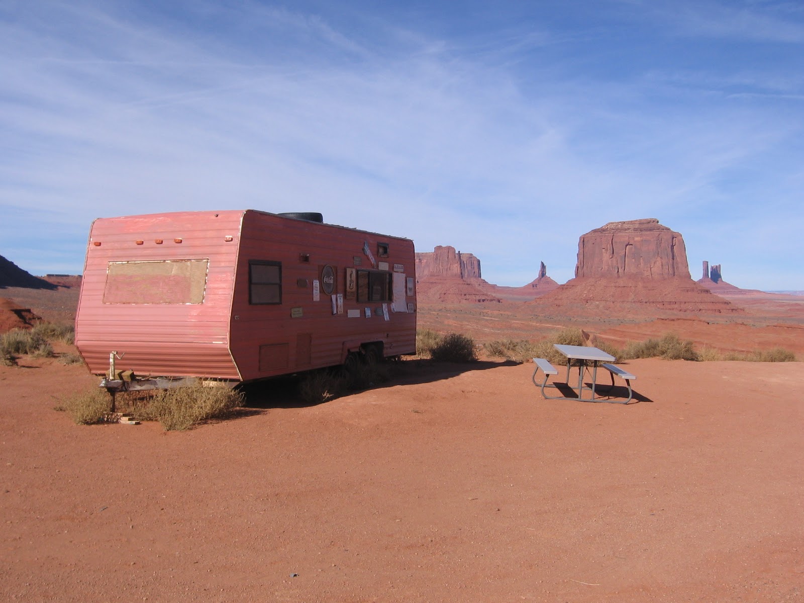
John Ford’s Point is the fourth point of interest on the Self Guiding Valley Drive Trail at Monument Valley Tribal Park in the Navajo Nation. Beside the view point, there is a short trail to walk and it is a center for viewing Navajo Arts and Crafts.


John Ford directed more than 140 films and won four Best Director Academy Awards and is regarded as one of the all time best directors. He pioneered location shooting and the long shots framing characters against rugged natural terrain such as here at Monument Valley.

Stagecoach in 1939 was the first in the series of seven Ford Westerns filmed on location in Monument Valley. It was nominated for seven Academy Awards including Best Picture and Best Director. Stagecoach was the film that elevated John Wayne to international stardom. The gift shop at the Visitor Center has several of these films for sale along with an assortment of John Wayne souvenirs.
 
Looking east, there is a head on view of Camel Butte, the fifth point of interest on the Valley Drive. Beyond is the Spearhead Mesa area that includes Artist’s Point, another major stop and view point.
 
Back to the west are the Three Sisters and Mitchell Mesa. The geology here is described as three main layers. The caprock Shinarump formation sits on the DeChelly or Cedar Mesa Sandstone that forms the sheer cliffs of the mesas and buttes. The stair steps below the buttes and spires are softer Organ Rock shales.


Part of the charm of John Ford’s Point is the array of Navajo vendors. The silver and turquoise jewelry draw a lot of attention. There is an opportunity to try the famous Navajo tacos featuring the fry bread shells as you gaze out toward Merrick Butte and the famous Mittens.


Thursday, November 18, 2010

Wildcat Trail at Monument Valley

The Wildcat Trail is a 3.2 mile lasso type loop in Monument Valley Tribal Park in the Navajo Nation along the Utah and Arizona border. It is the only hiking trail in Monument Valley that the public can travel without a guide. Most visitors at Monument Valley follow the self guiding Valley Drive or take a guided tour.


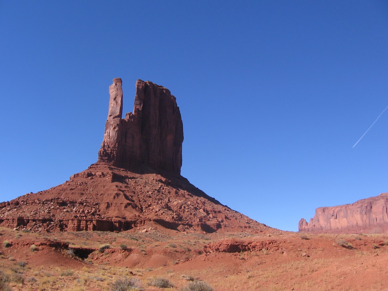
The trail head is near the visitor center, just past the right turn that descends to the Valley Drive. The trail makes a loop around the West Mitten, one of the most famous of the Monument Valley formations. There are also good views of the East Mitten.
 
Along the first segment are small signs identifying several of the desert plants. Besides the Broom Snakeweed, others mentioned include Russian Thistle, Rabbitbrush, Narrowleaf Yucca, Mormon Tea, Blackbrush, Cliff Rose, Threadleaf Groundsel, Prickly Pear Cactus, and there also scattered Utah Junipers. Along the north side of the trail is the massive Sentinel Mesa.
 

Around the north side of the loop are good views toward a group of formations that include the Big Indian, Castle Butte, King on his Throne, and Brigham’s Tomb.


Some of these same formations are among the ones in the famous view along Highway 163 approaching Monument Valley from the northeast.

Around the north side of the West Mitten I noticed a sliver of blue sky visible through the Mitten, a small arch forming. The opening is visible from both sides from the right angle, but is easier to see from the north side.
Around the east side of the loop, the trail passes directly between the East Mitten and the West Mitten.

 My hike took 1:45 hours on a 45 F degree mid November day. The park wasn’t very crowded and I saw 3 other hikers during my trip.


Wednesday, September 29, 2010

De-Na-Zin Wilderness

The De-Na-Zin access to the Bisti/ De-Na-Zin Wilderness area is on County Road 7500 about 13 miles west of the junction with Highway 550, near Huerfano in northwest New Mexico. This access is in the eastern part of the wilderness. From the more popular Bisti access, road 7500 is 8 miles south on highway 371, then east about 10 miles. The De-Na-Zin access isn’t marked very well, but it is the only place along road 7500 with room to pull over and park and with an obvious gate through the fence.

The first 200 yards of hiking is along a short section of road through a sagebrush field. Most of the terrain along road 7500 is similar rolling sagebrush fields with very few houses and a few oil and gas wells. The road ends abruptly at the edge of a colorful eroded basin.

There aren’t any official trails in the wilderness area. In the area where I descended into the basin, there was an old fence leading north and I followed it across the eroded clay and sandstone surface toward a rocky small mesa that was just to the west of the fence line.

The small mesa overlooked a wide eroded basin and the rocky area extended in pieces to the east. There were some sculpted formations, often called hoodoos, visible to the east and I hiked toward them. Across the eroded basin north were some tall hills that would offer some challenging and probably slippery climbing.

The sculpted formations included a small arch. There are several rocks in this area supported by thin pedestals and more good views north across the deep eroded basin.

Rather than retrace my steps, I tried to loop back south toward the road. There is an old road in this area that works as a trail for part of the way. This road leads further east and I didn’t see where it enters the area. Along this area there is some petrified wood visible.

Further on, I came across some rounded bowling ball sized rocks eroding out of a sandy wash. I’m not an expert, but these look like the formations that are called concretions. Concretions build up around a nucleus and are sometimes mistaken as fossil eggs. The last 0.5 miles of my hike were along the fence line near road 7500. My total hike was for 2:00 hours for about 4 miles on an unusually warm 80 F degree late September day. The sky was clear and I carried 3 liters of water. After this hike, I also visited the Bisti access on the west end of the wilderness area.


Tuesday, September 28, 2010

Bisti Wilderness

The Bisti/De-Na-Zin Wilderness is a 38,305 acres eroded badlands area south of Farmington in northwest New Mexico. The Bisti access is the west side of the area and is 36.5 miles south of the San Juan River along New Mexico route 371, then 2 miles east on county road 7297. Highway signs call attention to the Bisti Wilderness and there were three of four other vehicles there during my visit. There may be a second parking area a short distance north.

Standing at the entry sign and looking easterly at the odd terrain, it looked like most visitors hike slightly south and east where it appears flat and open, and there is a wide dry wash. There aren’t any official trails here, any maps, or any interpretation at the site.

The Fruitland Formation makes up most of what is visible and contains sandstones, shales, mudstones, coal, and silt. These formations are 65-80 million years old. Hiking east into the open area, there is a fenced in space with a pond inside that takes about 15 minutes to get past. I turned north at the fence line and walked into an area of colorful eroded hills.

I climbed a small hill for a view of the some of the nearby formations. There is an on-line brochure for the area available on the BLM web site. The brochure says that the red color that stands out is due to clay soils baked by coal fires while buried millions of years ago. It looked like some black coal seams were visible in the formations near the access parking area. I think a mile or so further east there is some petrified wood and some formations that are called the cracked eggs.


My hike at the Bisti access was only for 1:00 hour on a warm and sunny 85 F degree late September day. I only sampled the entry point in an area where there are many square miles to explore. I also visited the De-Na-Zin access, the eastern section, on the same day.

Monday, May 10, 2010

Wupatki Ruins Trail

The Wupatki Trail is 0.5 miles and visits the largest Ancestral Ruins site in Wupatki National Monument, near Flagstaff in northeast Arizona. Wupatki is in a unique location on the borders of several cultural traditions in the southwest and is also in one of the warmest and driest climates.

The Wupatki Trail begins at the Visitor Center and starts with a good overview of the site. There is a trail guide here with 20 stops and also interpretive signs in a few places. There are cinders in the area from the eruption of nearby Sunset Crater volcano. Wupatki was settled after the volcano eruption but it isn’t known if these two events are related. It is known that the volcanic ash retains moisture and may have helped with agriculture in an otherwise very dry area. Wupatki may have served as a trade area given its border location. The structure is three stories high in some places.

Like some other large sites in the region, the natural boulders form part of the structure. The stones used as bricks here are long and flat compared to the style used in the area close to Mesa Verde. I didn’t notice any dark basalt stones here as there are some of the other Wupatki National Monument sites.

North of the main structure there is a Great Kiva type structure. The interpretive information says that no evidence for a roof was found here and the typical floor features, like the ventilation system, of other Great Kivas are missing, so this may have been an open air community structure. In the colder climates, I usually think the kivas are best used for cold weather survival. Although it is warmer here than the higher elevation areas, there would still be some snow and cold here, and in the summers the sun would be too intense during most hours of the day without some sort of shade roof.

It does appear that there is a fire pit on the floor here. The bench area here is at a level that makes sitting practical. Sometimes, at other sites sitting on the bench is blocked by the low roof. Toward the end of the trail there is a smaller rectangular room that is described as a kiva.


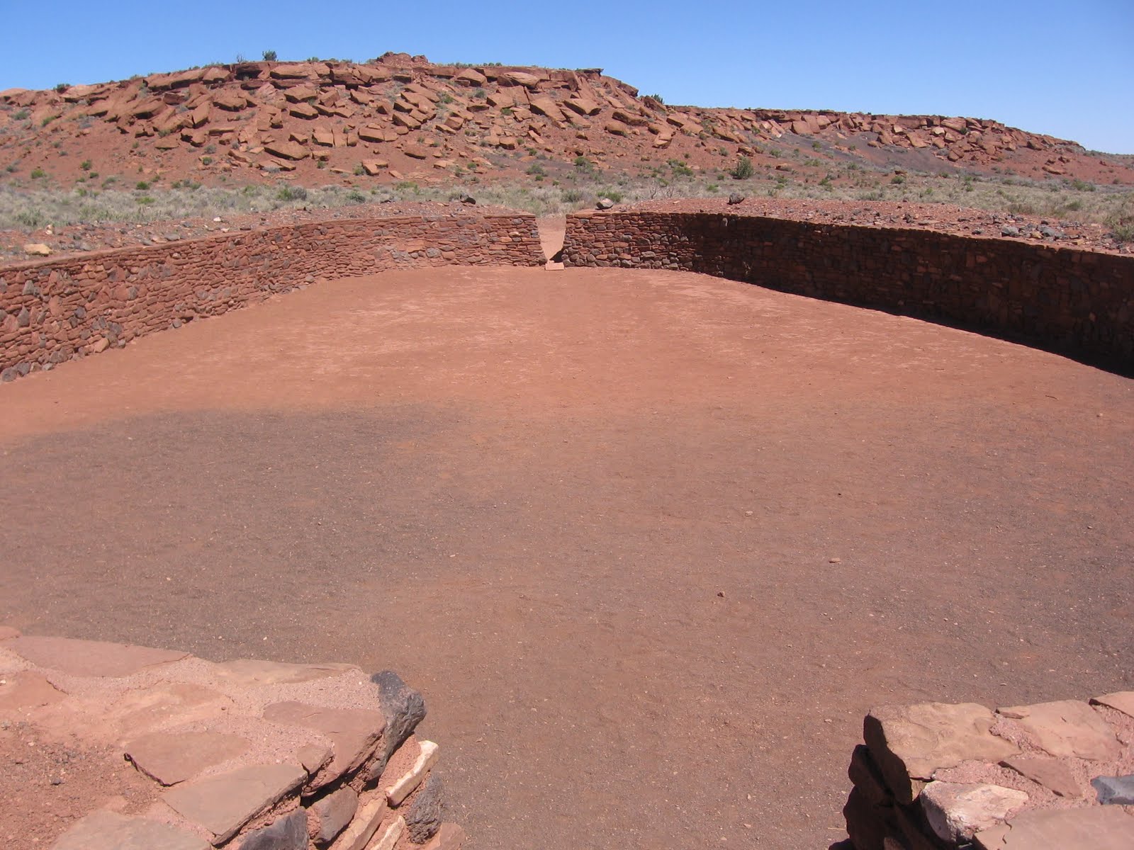
The most unique structure at Wupatki is the structure that is described as the ball court. Ball courts are common at sites in southern Arizona and it appears to be an idea from cultures in Mexico. The court here is 78 feet wide and 102 feet long with a 6 foot high wall. It is something like a hockey rink.

Next to the ball court is a geologic feature called a blowhole. This is a crevice in the earth surface that appears to breathe based on changes in atmospheric pressure. During my visit the blowhole was inhaling. I set my trail guide over the screened hole and felt it get pulled to the screen as if by a strong exhaust fan.


The return leg of the trail passes an area where Park Rangers lived in the early years of the park. Apparently parts of the ruins were rebuilt, but then disassembled later. One of the rooms on the back side of Wupatki is formed largely from natural boulders and visitors are allowed to enter this room.

The overall site is surrounded by many small dwellings. A few of them can be sighted, but they are off the trail and not accessible. The Visitor Center has several displays of artifacts and interpretation.